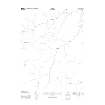
2013 Map of Hima
USGS Topo · Published 2013About this map
Woollum and Cottongim sit along the winding path of Collins Fork in this 2013 survey of Knox County. The landscape is defined by an intricate network of waterways like Disappointment Cr, Whites Br, and Horse Cr, which dictated the early settlement patterns of the region. Local history and genealogy researchers will find several family-named burial sites, including Frost Cem, Coy Cem, and Harris Cem, many located near old access roads like Cobb Cemetery Rd. A notable historical landmark, Baughs Salt Well, appears along the Collins Fork south of Park Valley, indicating the area's geological and industrial heritage. Small communities such as Pigeonroost, Sibert, and Bush remain connected by rural routes that trace the natural contours of the valley floors.
Find a feature on this map
73 named features on this map. Tap any name to fly to it.
Don’t see what you’re looking for? This feature index may not catch every label — zoom into the map to look around manually.
Map Details
Editions of this 2013 Hima Map
This is the sole edition of this map. No revisions or reprints were ever made.
Other maps of this area

1886 · Cumberland Gap
USGS Topo · 1:125,000

1888 · Cumberland Gap
USGS Topo · 1:125,000

1891 · Manchester
USGS Topo · 1:125,000

1891 · Cumberland Gap
USGS Topo · 1:125,000

1903 · Pineville
USGS Topo · 1:48,000

1952 · Portersburg
USGS Topo · 1:24,000

1952 · Heidrick
USGS Topo · 1:24,000

1952 · Hima
USGS Topo · 1:24,000

1952 · Blackwater
USGS Topo · 1:24,000

1952 · Fount
USGS Topo · 1:24,000