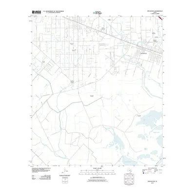
2010 Map of Hitchcock
USGS Topo · Published 2010About this map
Hitchcock and the surrounding coastal prairies of Galveston County appear as a landscape deeply shaped by petroleum extraction and drainage management at the turn of the 21st century. The map reveals an extensive network of petroleum resources, including the Greens Lake Oil Field, Sarah White Oil Field, and Johnnie Volk Field, which illustrate the industrial character of the region. This economic activity is balanced by significant civic spaces like the Galveston Memorial Cemetery and Grace Memorial Cemetery.
Find a feature on this map
57 named features on this map. Tap any name to fly to it.
Don’t see what you’re looking for? This feature index may not catch every label — zoom into the map to look around manually.
Map Details
Editions of this 2010 Hitchcock Map
This is the sole edition of this map. No revisions or reprints were ever made.
Other maps of this area

1929 · Dickinson
USGS Topo · 1:24,000

1929 · Karankawa Lake
USGS Topo · 1:24,000

1929 · Algoa
USGS Topo · 1:24,000

1929 · Hitchcock
USGS Topo · 1:24,000

1929 · Virginia Point
USGS Topo · 1:24,000

1929 · Texas City
USGS Topo · 1:24,000

1931 · Lake Como
USGS Topo · 1:24,000

1932 · Algoa
USGS Topo · 1:31,680

1932 · Dickinson
USGS Topo · 1:31,680

1932 · Texas City
USGS Topo · 1:31,680