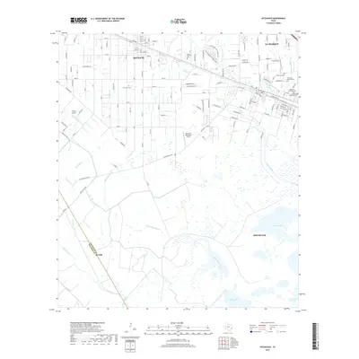
2019 Map of Hitchcock
USGS Topo · Published 2019About this map
Santa Fe and Hitchcock anchor a landscape defined by low-lying coastal prairies and a complex network of bayous as they appeared in 2019. This part of the Texas Gulf Coast exhibits a dense concentration of local memorial sites, including Alta Loma Cem, Grace Memorial Cem, and Galveston Memorial Cem, reflecting the deep-rooted community history between La Marque and Alvin. The map details a transition from the structured residential grids of the northern settlements to the expansive marshlands of Carancahua Bayou and Greens Lake in the south.
Find a feature on this map
145 named features on this map. Tap any name to fly to it.
Don’t see what you’re looking for? This feature index may not catch every label — zoom into the map to look around manually.
Map Details
Editions of this 2019 Hitchcock Map
This is the sole edition of this map. No revisions or reprints were ever made.
Other maps of this area

1929 · Dickinson
USGS Topo · 1:24,000

1929 · Karankawa Lake
USGS Topo · 1:24,000

1929 · Algoa
USGS Topo · 1:24,000

1929 · Hitchcock
USGS Topo · 1:24,000

1929 · Virginia Point
USGS Topo · 1:24,000

1929 · Texas City
USGS Topo · 1:24,000

1931 · Lake Como
USGS Topo · 1:24,000

1932 · Algoa
USGS Topo · 1:31,680

1932 · Dickinson
USGS Topo · 1:31,680

1932 · Texas City
USGS Topo · 1:31,680