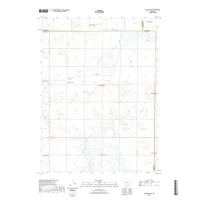
2017 Map of Hoagland NE
USGS Topo · Published 2017About this map
Wild Horse Flats dominates the landscape of this portion of Logan County, characterized by a complex network of wetlands and small water bodies that underscore the high water table of the Nebraska Sandhills. The terrain is defined by the drainage of Wild Horse Cr, which meanders through the northern sections of the map. Human infrastructure is sparse, limited to a handful of primary thoroughfares such as Wild Horse Creek Rd and Dunning Rd that navigate the depressions between the dunes. The map also records the jurisdictional boundaries where Logan County meets Thomas, Blaine, and Custer counties, illustrating the precise section-line grid that governs this cattle-ranching country. The abundance of unnamed small lakes and marshy areas indicates the vital role of the Ogallala Aquifer in sustaining this environment.
Find a feature on this map
16 named features on this map. Tap any name to fly to it.
Don’t see what you’re looking for? This feature index may not catch every label — zoom into the map to look around manually.
Map Details
Editions of this 2017 Hoagland NE Map
This is the sole edition of this map. No revisions or reprints were ever made.
Other maps of this area

1948 · Linscott
USGS Topo · 1:62,500

1948 · Halsey
USGS Topo · 1:62,500

1950 · Linscott
USGS Topo · 1:62,500

1950 · Halsey
USGS Topo · 1:62,500

1951 · Dunning
USGS Topo · 1:62,500

1951 · Hoagland
USGS Topo · 1:62,500

1954 · North Platte
USGS Topo · 1:250,000

1956 · North Platte
USGS Topo · 1:250,000

1957 · North Platte
USGS Topo · 1:250,000

1967 · North Platte
USGS Topo · 1:250,000