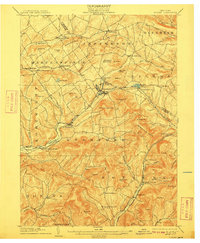
1904 Map of Hobart
USGS Topo · Published 1909About this map
The West Branch Delaware River carves through the Delaware and Schoharie county highlands, where the Ulster and Delaware RR follows the valley floor through Hobart and Stamford. This 1902 survey illustrates the intense concentration of upland farming and village life at the beginning of the twentieth century, anchored by the rail corridor that connected these Catskill mountain communities to broader markets. Settlements like South Gilboa Sta. and Roxbury serve as vital hubs along the tracks, while high-altitude landmarks such as Utsayantha Mt. and the Moresville Range overlook a landscape of named hills and family hollows. Genealogists can trace localized neighborhoods like West Settlement, Meeker Hollow Center, and Hubbell Corners, which reveal the granular social geography of the era. The presence of the Stamford Reservoir and several small ponds like Odell Lake and Mayham Pond highlights the region's managed water resources during this period of growth.
Find a feature on this map
84 named features on this map. Tap any name to fly to it.
Don’t see what you’re looking for? This feature index may not catch every label — zoom into the map to look around manually.
Map Details
Editions of this 1904 Hobart Map
5 editions found
Other maps of this area

1898 · Schoharie
USGS Topo · 1:62,500

1900 · Schoharie
USGS Topo · 1:62,500

1900 · Phoenicia
USGS Topo · 1:62,500

1901 · Margaretville
USGS Topo · 1:62,500

1901 · Gilboa
USGS Topo · 1:62,500

1903 · Gilboa
USGS Topo · 1:62,500

1903 · Phoenicia
USGS Topo · 1:62,500

1904 · Richmondville
USGS Topo · 1:62,500

1904 · Hobart
USGS Topo · 1:62,500

1904 · Margaretville
USGS Topo · 1:62,500