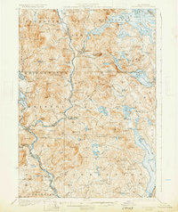
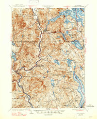
1927 Map of Holderness
USGS Topo · Published 1931About this map
Holderness and the surrounding lake country of central New Hampshire appear here as a landscape of interconnected waters and upland farm districts during the mid-1920s. The Pemigewasset River serves as a central artery, winding past the village of Ashland and through Bristol, where it passes Profile Falls. To the east, the sprawling reaches of Squam Lake and Lake Winnisquam dominate the geography, their shorelines punctuated by points like Cromwell Pt and Pt Finisterre.
Find a feature on this map
111 named features on this map. Tap any name to fly to it.
Don’t see what you’re looking for? This feature index may not catch every label — zoom into the map to look around manually.
Map Details
Editions of this 1927 Holderness Map
6 editions found
Other maps of this area

1909 · Winnepesaukee
USGS Topo · 1:62,500

1919 · Gilmanton
USGS Topo · 1:62,500

1925 · Holderness
USGS Topo · 1:62,500

1927 · Penacook
USGS Topo · 1:62,500

1927 · Gilmanton
USGS Topo · 1:62,500

1927 · Holderness
USGS Topo · 1:62,500

1927 · Cardigan
USGS Topo · 1:62,500

1928 · Mount Kearsarge
USGS Topo · 1:62,500

1928 · Plymouth
USGS Topo · 1:62,500

1928 · Rumney
USGS Topo · 1:62,500