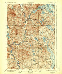
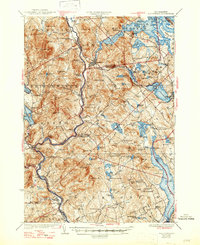
1927 Map of Holderness
USGS Topo · Published 1936About this map
Ashland and the surrounding lake country of Belknap Co and Grafton Co appear here during a period of established rural community and early automotive transit. The Pemigewasset River serves as a central artery, flanked by the Boston And Maine Railroad which connects the manufacturing and trading hubs of Bristol and Ashland. This landscape is exceptionally dense with early educational history, featuring dozens of named schoolhouses such as Sargent School, Hanaford School, and Steele School that served isolated upland farmsteads.
Find a feature on this map
126 named features on this map. Tap any name to fly to it.
Don’t see what you’re looking for? This feature index may not catch every label — zoom into the map to look around manually.
Map Details
Editions of this 1927 Holderness Map
6 editions found
Other maps of this area

1909 · Winnepesaukee
USGS Topo · 1:62,500

1919 · Gilmanton
USGS Topo · 1:62,500

1925 · Holderness
USGS Topo · 1:62,500

1927 · Penacook
USGS Topo · 1:62,500

1927 · Gilmanton
USGS Topo · 1:62,500

1927 · Holderness
USGS Topo · 1:62,500

1927 · Cardigan
USGS Topo · 1:62,500

1928 · Mount Kearsarge
USGS Topo · 1:62,500

1928 · Plymouth
USGS Topo · 1:62,500

1928 · Rumney
USGS Topo · 1:62,500