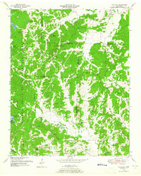
1950 Map of Holladay
USGS Topo · Published 1965About this map
Natchez Trace State Park and Forest dominates the western half of this 1950s landscape, where the wooded ridges and creek bottoms meet at the intersection of Benton, Carroll, Henderson, and Decatur counties. This survey, based on 1947 and 1950 photography, captures a rural Tennessee community defined by its family burial grounds and small country congregations. Local life is anchored by the village of Holladay in the northeast and the Shiloh settlement to the west. The terrain is marked by numerous small-scale institutions like Poplar Springs Sch and Hydro Sch, alongside a dense network of cemeteries such as Holladay Cem and Beasley Cem. The presence of the Maple Creek Lookout Tower near Maple Creek Lake highlights the era's focus on forest management within the state park boundaries, while the numerous church-centered communities like New Prospect Ch and Franks Chapel illustrate the decentralized settlement patterns of the period.
Find a feature on this map
61 named features on this map. Tap any name to fly to it.
Don’t see what you’re looking for? This feature index may not catch every label — zoom into the map to look around manually.
Map Details
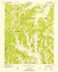
Editions of this 1950 Holladay Map
3 editions found
Other maps of this area

1936 · Yuma
USGS Topo · 1:24,000

1936 · Parsons
USGS Topo · 1:24,000

1936 · Seventeen Creek
USGS Topo · 1:24,000

1936 · Jeannette
USGS Topo · 1:24,000

1936 · Sugar Tree
USGS Topo · 1:24,000

1936 · Cavvia
USGS Topo · 1:24,000

1936 · Buena Vista
USGS Topo · 1:24,000

1936 · Rockport
USGS Topo · 1:24,000

1936 · Chesterfield
USGS Topo · 1:24,000
1949 · Jeannette
USGS Topo · 1:24,000