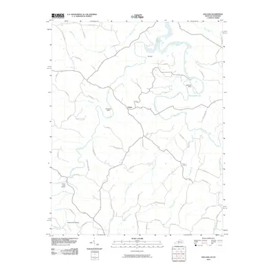
2010 Map of Holland
USGS Topo · Published 2010About this map
Holland serves as the central hub for this portion of southern Kentucky, where the winding course of the Barren River creates distinct geographic landmarks. The river's sharp meanders are clearly defined at Jewsharp Bend and Horseshoe Bend, both of which are now part of the wider Barren River Lake system. The terrain is defined by its karst topography, notably at The Sink, and a network of hollows such as Emma Cook Hollow and Hanging Rock Hollow along the southern reaches near Hanging Rock Branch.
Find a feature on this map
57 named features on this map. Tap any name to fly to it.
Don’t see what you’re looking for? This feature index may not catch every label — zoom into the map to look around manually.
Map Details
Editions of this 2010 Holland Map
This is the sole edition of this map. No revisions or reprints were ever made.
Other maps of this area

1926 · Scottsville
USGS Topo · 1:62,500

1931 · Lafayette
USGS Topo · 1:62,500

1931 · Red Boiling Springs
USGS Topo · 1:62,500

1953 · Tracy
USGS Topo · 1:24,000

1954 · Austin
USGS Topo · 1:24,000

1954 · Fountain Run
USGS Topo · 1:24,000

1954 · Petroleum
USGS Topo · 1:24,000

1954 · Scottsville
USGS Topo · 1:24,000

1954 · Holland
USGS Topo · 1:24,000

1956 · Corbin
USGS Topo · 1:250,000