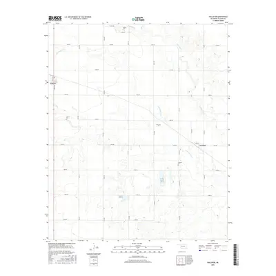
2016 Map of Hollister
USGS Topo · Published 2016About this map
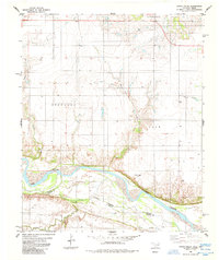
Hollister and Loveland anchor this agricultural landscape in Tillman County, where a grid of rural section-line roads defines the local geography. The area is dissected by the meandering courses of Deep Red Cr and Little Deep Red Cr, which create irregular breaks in the otherwise orderly pattern of Oklahoma farm country. These waterways, along with Horse Cr in the north, were foundational to the early development of the region's ranching and farming operations. Family and community heritage is deeply rooted here, evidenced by the distribution of local burial grounds such as Isadore Cem, Amyx Cem, and the municipal Hollister and Loveland Cem locations. The 2016 data shows a transition from the compact town centers near Majors Ave and Harris St into the expansive, numbered road network that serves the surrounding prairie.
Find a feature on this map
32 named features on this map. Tap any name to fly to it.
Don’t see what you’re looking for? This feature index may not catch every label — zoom into the map to look around manually.
Map Details
Editions of this 2016 Hollister Map
This is the sole edition of this map. No revisions or reprints were ever made.
Other maps of this area

1955 · Lawton
USGS Topo · 1:250,000

1957 · Burkburnett
USGS Topo · 1:62,500

1958 · Electra
USGS Topo · 1:62,500

1962 · Chattanooga
USGS Topo · 1:62,500

1974 · Hollister NW
USGS Topo · 1:24,000

1974 · Hackberry Flat
USGS Topo · 1:24,000
1974 · Hollister
USGS Topo · 1:24,000
1974 · Hollister NE
USGS Topo · 1:24,000
1984 · Cowboy Springs
USGS Topo · 1:24,000
1985 · Augur Creek
USGS Topo · 1:24,000