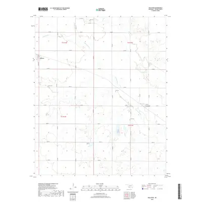
2018 Map of Hollister
USGS Topo · Published 2018About this map
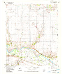
Hollister and Loveland anchor this Tillman County landscape, where the agricultural grid is deeply intertwined with the drainage systems of Deep Red Creek and its tributaries. The map reveals a high density of small family or community burial grounds, including Isadore Cemetery near the northern boundary and Amyx Cemetery situated north of Loveland. These sites, along with Hollister Cemetery and Loveland Cemetery, indicate the enduring genealogical footprint of early homesteading families in this section of Oklahoma. The terrain is defined by the winding paths of Little Deep Red Creek and Horse Creek, which break the regularity of the section-line roads such as Pasture Road and Grand Avenue. This survey documents a quiet rural economy defined by wide-open pastures and established township boundaries like t2s r16w and t3s r15w.
Find a feature on this map
34 named features on this map. Tap any name to fly to it.
Don’t see what you’re looking for? This feature index may not catch every label — zoom into the map to look around manually.
Map Details
Editions of this 2018 Hollister Map
This is the sole edition of this map. No revisions or reprints were ever made.
Other maps of this area

1955 · Lawton
USGS Topo · 1:250,000

1957 · Burkburnett
USGS Topo · 1:62,500

1958 · Electra
USGS Topo · 1:62,500

1962 · Chattanooga
USGS Topo · 1:62,500

1974 · Hollister NW
USGS Topo · 1:24,000

1974 · Hackberry Flat
USGS Topo · 1:24,000
1974 · Hollister
USGS Topo · 1:24,000
1974 · Hollister NE
USGS Topo · 1:24,000
1984 · Cowboy Springs
USGS Topo · 1:24,000
1985 · Augur Creek
USGS Topo · 1:24,000