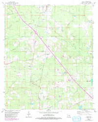
1980 Map of Holly
USGS Topo · Published 1982About this map
Lands End Plantation anchors the northwestern corner of this De Soto Parish landscape, which is defined by a dense network of slow-moving waterways and active energy extraction. By the early 1980s, the Holly Oil and Gas Field dominated the southern terrain, interspersed with scattered rural settlements like Holly and Kingston. The map documents a transition from traditional agrarian land use to industrial resource management, evidenced by the presence of a Drill Hole, Oil Well, and Gravel Pit alongside local landmarks such as Kingston Station.
Find a feature on this map
35 named features on this map. Tap any name to fly to it.
Don’t see what you’re looking for? This feature index may not catch every label — zoom into the map to look around manually.
Map Details
Editions of this 1980 Holly Map
2 editions found
Other maps of this area

1945 · Grand Cane
USGS Topo · 1:62,500

1945 · Greenwood
USGS Topo · 1:62,500

1945 · Mansfield
USGS Topo · 1:62,500

1947 · Mansfield
USGS Topo · 1:62,500

1948 · Caspiana
USGS Topo · 1:62,500

1955 · Shreveport
USGS Topo · 1:250,000

1955 · Caspiana
USGS Topo · 1:62,500

1955 · Greenwood
USGS Topo · 1:62,500

1956 · Shreveport
USGS Topo · 1:250,000
1957 · Grand Cane
USGS Topo · 1:62,500