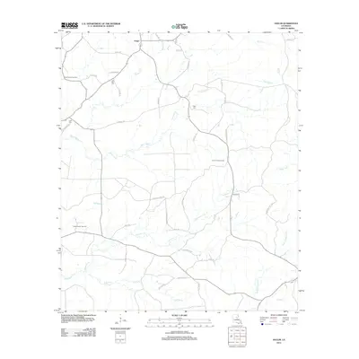
2012 Map of Holum
USGS Topo · Published 2012About this map
Holum anchors this portion of Caldwell Parish, a landscape defined by an intricate network of waterways and timber-rich bottomlands. The area is characterized by slow-moving drainages like Black Bayou and Chickasaw Cr, which snake through the terrain alongside newer industrial developments. The presence of the Holum Lookout Tower suggests a history of forest management and fire watch, while the Pistol Thicket Gas Field and Rabbit Branch Gas Field indicate the local economic reliance on subterranean resources. For those tracing local families, several small burial grounds are identified, including Little Star Cem and Tingle Cem. The southern reach of the map features the distinctive Laffoon Cutoff and the uniquely named Bayou Funny Louis, illustrating the complex hydrology of the Louisiana piney woods and bayou country as it appeared in the early 21st century.
Find a feature on this map
46 named features on this map. Tap any name to fly to it.
Don’t see what you’re looking for? This feature index may not catch every label — zoom into the map to look around manually.
Map Details
Editions of this 2012 Holum Map
This is the sole edition of this map. No revisions or reprints were ever made.
Other maps of this area

1939 · Fort Necessity
USGS Topo · 1:62,500

1940 · Columbia
USGS Topo · 1:62,500

1941 · Harrisonburg
USGS Topo · 1:62,500

1953 · Alexandria
USGS Topo · 1:250,000

1953 · Natchez
USGS Topo · 1:250,000

1955 · Jackson
USGS Topo · 1:250,000

1955 · Shreveport
USGS Topo · 1:250,000

1955 · Alexandria
USGS Topo · 1:250,000

1955 · Olla
USGS Topo · 1:62,500

1956 · Shreveport
USGS Topo · 1:250,000