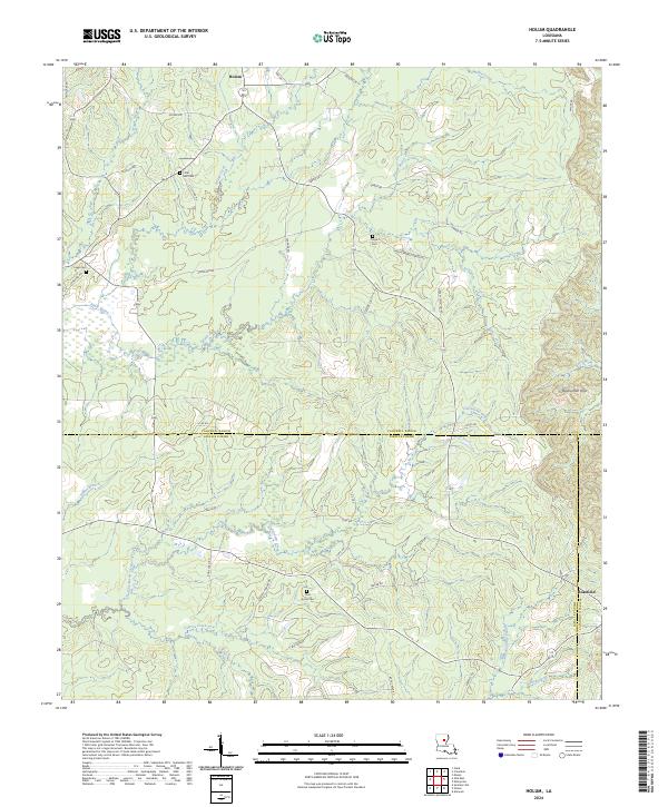
2024 Map of Holum
USGS Topo · Published 2024About this map
Holum and the nearby Rosefield community sit within a landscape defined by the intersection of three Louisiana parishes. This 2024 survey documents the dense network of drainage systems cutting through the Bayou Dan Hills, where Black Bayou and Bayou Funny Louis dictate the local topography. The map reveals a pattern of dispersed settlement, with family-named landmarks and rural burial grounds such as Little Star Cem, Tingle Cem, and Pine Grove Cem serving as significant points for genealogical research. The complex parish boundaries between Caldwell Parish and LaSalle Parish and LaSalle Parish and Catahoula Parish are precisely delineated, showing how administrative lines navigate the winding courses of Chickasaw Creek and Neal Branch. Numerous logging and parish roads, including Ip 44 RD and Laffoon Cutoff, provide a detailed record of modern access across this timber-rich terrain.
Find a feature on this map
60 named features on this map. Tap any name to fly to it.
Don’t see what you’re looking for? This feature index may not catch every label — zoom into the map to look around manually.
Map Details
Editions of this 2024 Holum Map
This is the sole edition of this map. No revisions or reprints were ever made.
Other maps of this area

1939 · Fort Necessity
USGS Topo · 1:62,500

1940 · Columbia
USGS Topo · 1:62,500

1941 · Harrisonburg
USGS Topo · 1:62,500

1953 · Alexandria
USGS Topo · 1:250,000

1953 · Natchez
USGS Topo · 1:250,000

1955 · Jackson
USGS Topo · 1:250,000

1955 · Shreveport
USGS Topo · 1:250,000

1955 · Alexandria
USGS Topo · 1:250,000

1955 · Olla
USGS Topo · 1:62,500

1956 · Shreveport
USGS Topo · 1:250,000