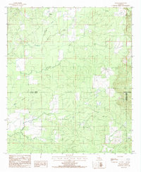
1984 Map of Holum
USGS Topo · Published 1985About this map
The settlement of Holum anchors the northern portion of this landscape at the intersection of several local routes. This mid-1980s survey captures a rural territory defined by its dense network of waterways, where the parish lines of Caldwell, La Salle, and Catahoula converge. The topography is intricately carved by several drainages, most notably Funny Louis Bayou and Chickasaw Creek, which flow through the wooded terrain.
Find a feature on this map
12 named features on this map. Tap any name to fly to it.
Don’t see what you’re looking for? This feature index may not catch every label — zoom into the map to look around manually.
Map Details
Editions of this 1984 Holum Map
This is the sole edition of this map. No revisions or reprints were ever made.
Other maps of this area

1939 · Fort Necessity
USGS Topo · 1:62,500

1940 · Columbia
USGS Topo · 1:62,500

1941 · Harrisonburg
USGS Topo · 1:62,500

1953 · Alexandria
USGS Topo · 1:250,000

1953 · Natchez
USGS Topo · 1:250,000

1955 · Jackson
USGS Topo · 1:250,000

1955 · Shreveport
USGS Topo · 1:250,000

1955 · Alexandria
USGS Topo · 1:250,000

1955 · Olla
USGS Topo · 1:62,500

1956 · Shreveport
USGS Topo · 1:250,000