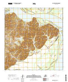
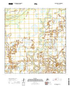
2019 Map of Holy Cross A-2 NW
USGS Topo · Published 2019About this map
Holy Cross sits at a critical junction of terrestrial and riverine geography along the Yukon River in the Yukon-Koyukuk Census Area. This 2019 survey captures the community’s layout at the edge of the Walker Slough, where a small network of local routes like Big Lake Road and Beach Road serve the interior, while the Holy Cross Airport provides the essential modern connection to the outside world. The terrain is dominated by the Holy Cross Hills to the west, rising sharply from the riverbanks to provide a natural barrier between the Yukon and the Koserefski River. To the north and south, the landscape is defined by the complex hydrology of the river delta, including Gost Creek, Whitehorse Creek, and Red Wing Slough. These waterways suggest a landscape where seasonal changes and water levels dictate movement and land use near landmarks like Dividing Point and Lucky Point.
Find a feature on this map
22 named features on this map. Tap any name to fly to it.
Don’t see what you’re looking for? This feature index may not catch every label — zoom into the map to look around manually.
Map Details
Editions of this 2019 Holy Cross A-2 NW Map
This is the sole edition of this map. No revisions or reprints were ever made.
Other maps of this area

1951 · Holy Cross
USGS Topo · 1:250,000

1952 · Holy Cross B-2
USGS Topo · 1:63,360

1952 · Holy Cross A-2
USGS Topo · 1:63,360

1952 · Holy Cross B-3
USGS Topo · 1:63,360

1952 · Holy Cross A-3
USGS Topo · 1:63,360

1952 · Holy Cross
USGS Topo · 1:250,000
2017 · Holy Cross A-3 NE
USGS Topo · 1:25,000
2017 · Holy Cross B-3 SE
USGS Topo · 1:25,000
2017 · Holy Cross A-3 SE
USGS Topo · 1:25,000
2019 · Holy Cross A-2 SE
USGS Topo · 1:25,000