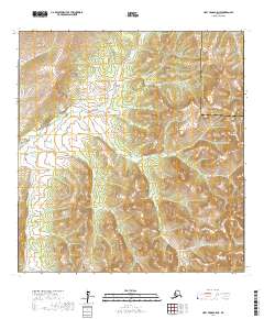
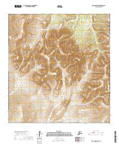
2017 Map of Holy Cross A-5 NE
USGS Topo · Published 2017About this map
Nageethluk River winds through the southwestern and central portions of this interior landscape, marking a terrain defined by complex hydrography and shifting wetlands. In this 2017 study, the river serves as a primary geographical marker within the Kusilvak Census Area, showing the intricate drainage patterns characteristic of the region. To the northeast, the Hawk River enters the frame, cutting through the high-elevation contours that separate the two drainage basins. The boundary between the Kusilvak Census Area and the Yukon-Koyukuk Census Area is clearly delineated, providing a specific administrative context for this remote part of the Alaskan wilderness. This map is particularly valuable for understanding the natural waterways before any significant human development, capturing the raw topography of the land between these major census divisions.
Find a feature on this map
8 named features on this map. Tap any name to fly to it.
Don’t see what you’re looking for? This feature index may not catch every label — zoom into the map to look around manually.
Map Details
Editions of this 2017 Holy Cross A-5 NE Map
This is the sole edition of this map. No revisions or reprints were ever made.
Other maps of this area

1951 · Holy Cross
USGS Topo · 1:250,000

1951 · Holy Cross A-5
USGS Topo · 1:63,360

1952 · Holy Cross A-4
USGS Topo · 1:63,360

1952 · Holy Cross B-5
USGS Topo · 1:63,360

1952 · Holy Cross B-4
USGS Topo · 1:63,360

1952 · Holy Cross
USGS Topo · 1:250,000
1952 · Holy Cross A-5
USGS Topo · 1:63,360
2017 · Holy Cross B-4 SW
USGS Topo · 1:25,000
2017 · Holy Cross A-4 NW
USGS Topo · 1:25,000
2017 · Holy Cross B-5 SW
USGS Topo · 1:25,000