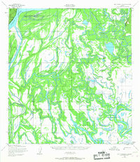
1952 Map of Holy Cross D-2
USGS Topo · Published 1967About this map
Holikachuk stands as the primary settlement within this vast labyrinth of waterways in the early 1950s. The landscape is defined by the massive Yukon River on the western edge, which feeds into a complex network of meandering channels and marshes. The Shageluk Slough and Innoko River dominate the central and eastern portions of the map, illustrating the seasonal floodplains that dictated movement and subsistence in this part of Alaska.
Find a feature on this map
7 named features on this map. Tap any name to fly to it.
Don’t see what you’re looking for? This feature index may not catch every label — zoom into the map to look around manually.
Map Details
Editions of this 1952 Holy Cross D-2 Map
2 editions found
Other maps of this area

1951 · Unalakleet
USGS Topo · 1:250,000

1951 · Holy Cross
USGS Topo · 1:250,000

1952 · Unalakleet A-2
USGS Topo · 1:63,360

1952 · Unalakleet A-3
USGS Topo · 1:63,360

1952 · Unalakleet A-1
USGS Topo · 1:63,360

1952 · Holy Cross C-2
USGS Topo · 1:63,360

1952 · Holy Cross C-1
USGS Topo · 1:63,360

1952 · Holy Cross D-2
USGS Topo · 1:63,360

1952 · Holy Cross D-3
USGS Topo · 1:63,360

1952 · Holy Cross D-1
USGS Topo · 1:63,360