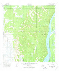
1952 Map of Holy Cross D-3
USGS Topo · Published 1974About this map
Yukon River dominance defines this 1952 topographic study, showing the waterway's expansive reach and the landforms it shapes, such as the prominent Eagle Island. Along the western bank, the settlement of Grayling is depicted during its mid-century development, marked by its Corporate Boundary and a vital Landing Strip. The landscape transitions from the river valley into a complex network of upland drainages, including Blueberry Creek and Grayling Creek.
Find a feature on this map
11 named features on this map. Tap any name to fly to it.
Don’t see what you’re looking for? This feature index may not catch every label — zoom into the map to look around manually.
Map Details
Editions of this 1952 Holy Cross D-3 Map
2 editions found
Other maps of this area

1951 · Unalakleet
USGS Topo · 1:250,000

1951 · Holy Cross
USGS Topo · 1:250,000

1952 · Unalakleet A-2
USGS Topo · 1:63,360

1952 · Unalakleet A-4
USGS Topo · 1:63,360

1952 · Unalakleet A-3
USGS Topo · 1:63,360

1952 · Holy Cross C-2
USGS Topo · 1:63,360

1952 · Holy Cross D-4
USGS Topo · 1:63,360

1952 · Holy Cross D-2
USGS Topo · 1:63,360

1952 · Holy Cross D-3
USGS Topo · 1:63,360

1952 · Holy Cross C-3
USGS Topo · 1:63,360