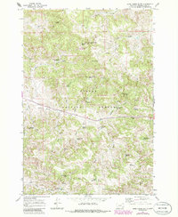
1966 Map of Home Creek Butte
USGS Topo · Published 1986About this map
Home Creek Butte rises as a prominent landmark within the Custer National Forest, overlooking a landscape defined by an extensive network of springs and man-made water catchments. This 1966 survey, with later revisions, documents the essential water infrastructure of the Powder River region, including the Fly Creek Res, Logging Creek Reservoir, and the Hird Reservoirs. The presence of numerous named springs such as Hanson Spring, Lemonade Spring, and Wesco Spring highlights the vital importance of surface water in this arid stretch of Montana.
Find a feature on this map
43 named features on this map. Tap any name to fly to it.
Don’t see what you’re looking for? This feature index may not catch every label — zoom into the map to look around manually.
Map Details
Editions of this 1966 Home Creek Butte Map
2 editions found

Other maps of this area

1954 · Hardin
USGS Topo · 1:250,000

1954 · Ekalaka
USGS Topo · 1:250,000

1956 · Ekalaka
USGS Topo · 1:250,000

1957 · Hardin
USGS Topo · 1:250,000

1958 · Ekalaka
USGS Topo · 1:250,000

1958 · Hardin
USGS Topo · 1:250,000

1965 · Ekalaka
USGS Topo · 1:250,000

1966 · Sonnette
USGS Topo · 1:24,000

1966 · Coleman Draw
USGS Topo · 1:24,000

1966 · Stacey
USGS Topo · 1:24,000