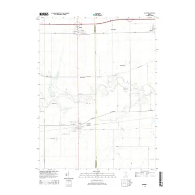
2015 Map of Homer
USGS Topo · Published 2015About this map
The Salt Fork river winds through this portion of east-central Illinois, defining the rural landscape between Homer and Ogden. This 2015 survey illustrates a region where established agricultural settlements meet managed natural spaces, most notably at Homer Lake and the recreational waters of Timberlake Farms Lake. The map provides significant detail for genealogists and local historians, particularly within the village of Homer, where the Homer Grand Army of the Republic Cem serves as a notable landmark of the community's heritage. To the north, the corridor following Interstate 74 connects the town of Ogden with the smaller locale of Fithian across the Champaign and Vermilion county line. Outside the primary townships, features like the Wilson Airport and Bodkin Cem appear alongside a network of county roads, such as Lincoln Trail Rd and Catlin Homer Rd, which trace the legacy of early prairie transit routes.
Find a feature on this map
45 named features on this map. Tap any name to fly to it.
Don’t see what you’re looking for? This feature index may not catch every label — zoom into the map to look around manually.
Map Details
Editions of this 2015 Homer Map
This is the sole edition of this map. No revisions or reprints were ever made.
Other maps of this area

1906 · Urbana
USGS Topo · 1:62,500

1931 · Fithian
USGS Topo · 1:48,000

1943 · Fithian
USGS Topo · 1:62,500

1953 · Danville
USGS Topo · 1:250,000

1953 · Indianapolis
USGS Topo · 1:250,000

1955 · Danville
USGS Topo · 1:250,000

1956 · Danville
USGS Topo · 1:250,000

1956 · Indianapolis
USGS Topo · 1:250,000

1956 · Newman
USGS Topo · 1:62,500

1956 · Villa Grove
USGS Topo · 1:62,500