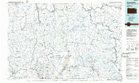
1986 Map of Honesdale
USGS Topo · Published 1986About this map
The Moosic Mountains dominate the central corridor of this Northeastern Pennsylvania landscape, where the coal-country history of the Lackawanna River valley meets the watershed of the Susquehanna River. The settlement pattern reflects the industrial and transit routes of the mid-20th century, with significant urban centers like Carbondale and Honesdale serving as hubs for smaller rail and mining towns such as Simpson, Richmondale, and Forest City.
Find a feature on this map
136 named features on this map. Tap any name to fly to it.
Don’t see what you’re looking for? This feature index may not catch every label — zoom into the map to look around manually.
Map Details
Editions of this 1986 Honesdale Map
2 editions found
Other maps of this area

1889 · Scranton
USGS Topo · 1:62,500

1891 · Scranton
USGS Topo · 1:62,500

1891 · Harveys Lake
USGS Topo · 1:62,500

1892 · Honesdale
USGS Topo · 1:62,500

1892 · Dundaff
USGS Topo · 1:62,500

1893 · Harvey Lake
USGS Topo · 1:62,500

1893 · Pittston
USGS Topo · 1:62,500

1893 · Scranton
USGS Topo · 1:62,500

1901 · Apalachin
USGS Topo · 1:62,500

1904 · Binghamton
USGS Topo · 1:62,500