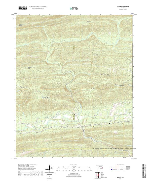
2022 Map of Honobia
USGS Topo · Published 2022About this map
Honobia sits at the intersection of several mountain ridges and valleys where the borders of Le Flore, Pushmataha, and McCurtain counties meet. The landscape is defined by the high elevations of the Kiamichi Mountains to the north and the Boktuklo Mountains to the south, with the Little River winding through the central lowlands. This 2022 survey captures a remote portion of southeastern Oklahoma where travel is dictated by winding routes such as the Indian Hwy and Honobia Trl. For genealogists and local historians, the map identifies specific community landmarks including Rock Creek Cem and Springhill Cem. The topographical detail highlights numerous named landforms like Deadman Mtn, Wildhorse Mtn, and Wolf Ridge, reflecting a history of local nomenclature tied to the prominent peaks and hollows of the Ouachita range.
Find a feature on this map
39 named features on this map. Tap any name to fly to it.
Don’t see what you’re looking for? This feature index may not catch every label — zoom into the map to look around manually.
Map Details
Editions of this 2022 Honobia Map
This is the sole edition of this map. No revisions or reprints were ever made.
Other maps of this area

1900 · Winding Stair
USGS Topo · 1:125,000

1901 · Tuskahoma
USGS Topo · 1:125,000

1901 · Alikchi
USGS Topo · 1:125,000

1902 · Lukfata
USGS Topo · 1:125,000

1908 · Tuskahoma
USGS Topo · 1:125,000

1909 · Tuskahoma
USGS Topo · 1:125,000

1909 · Winding Stair
USGS Topo · 1:125,000

1950 · Mcalester
USGS Topo · 1:250,000

1960 · Bethel
USGS Topo · 1:62,500

1962 · McAlester
USGS Topo · 1:250,000