
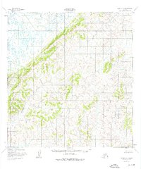
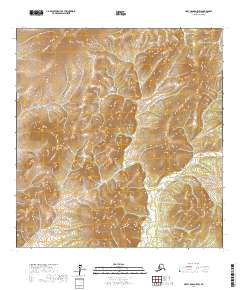
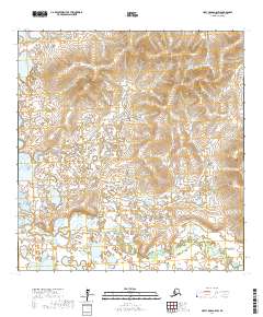
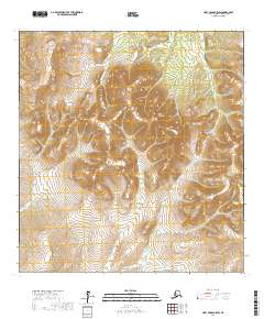
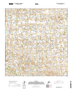
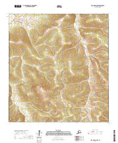
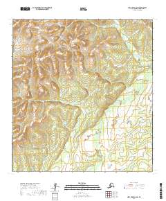
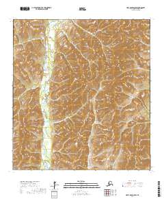
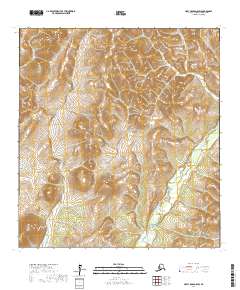
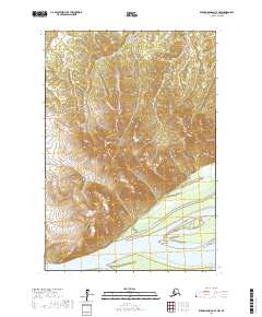
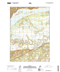
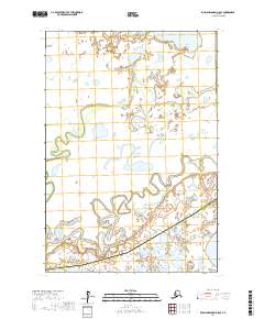
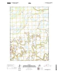
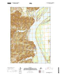
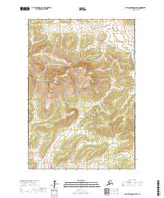
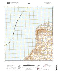
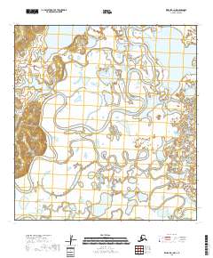
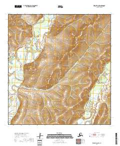
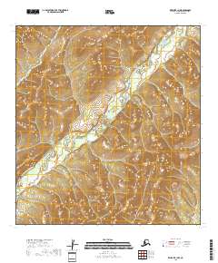
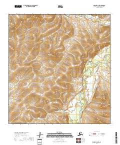
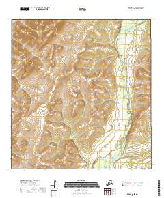
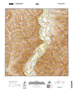
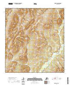
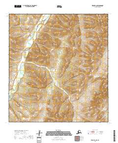
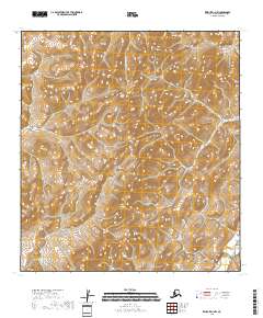
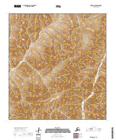
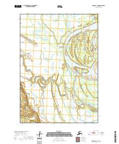
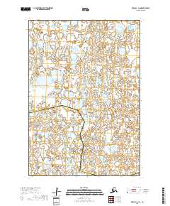
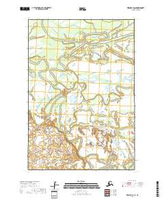
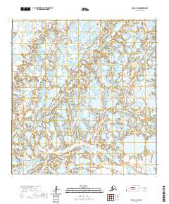
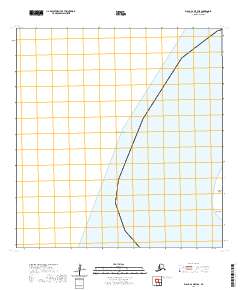
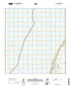
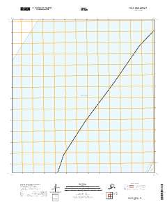
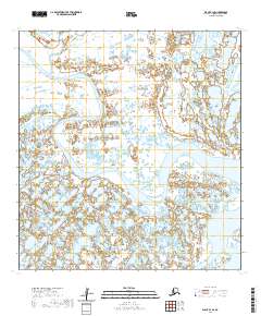
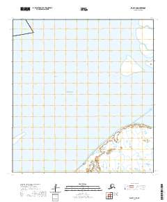
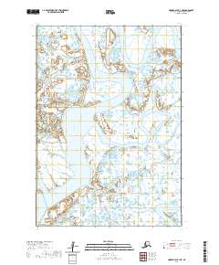
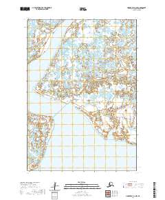
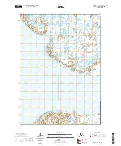
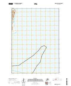
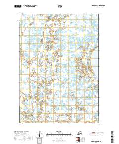
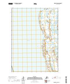
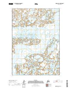
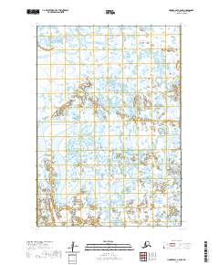
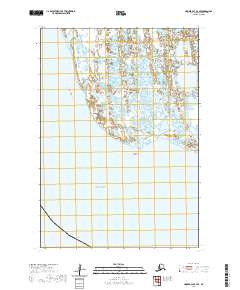
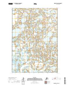
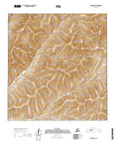
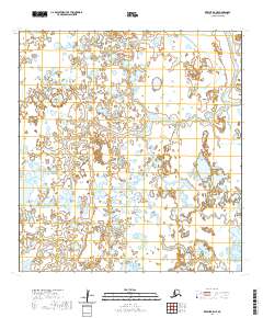
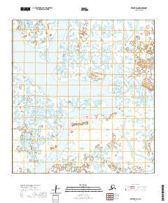
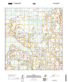
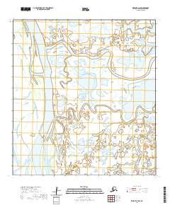
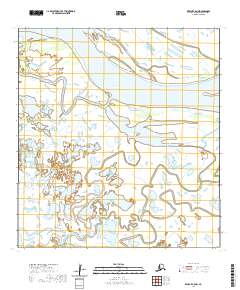
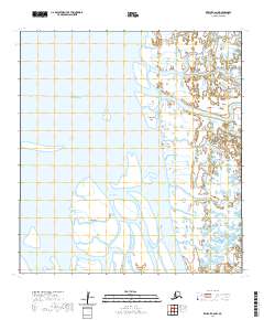
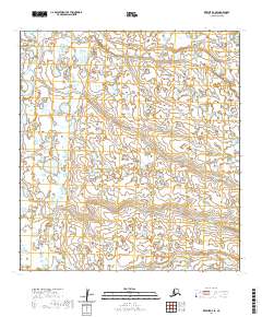
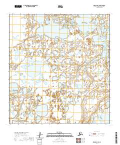
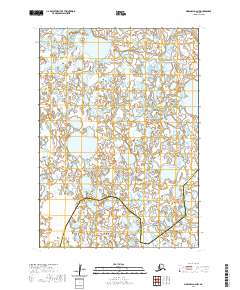
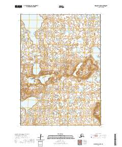
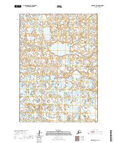
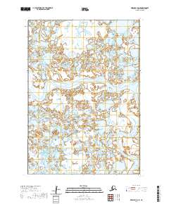
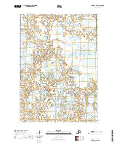
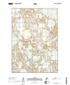
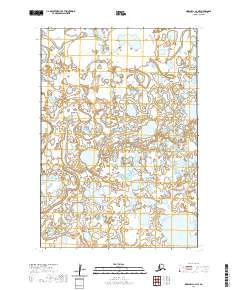
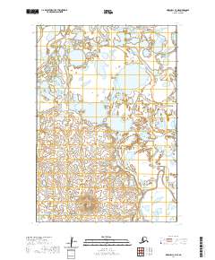
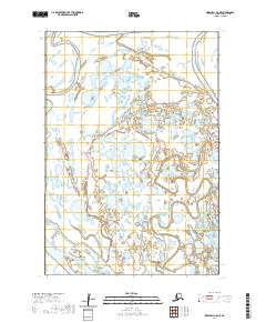
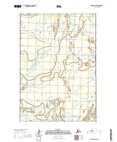
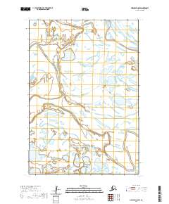
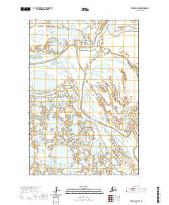
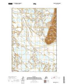
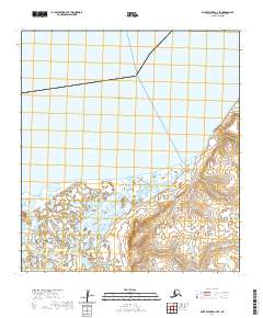
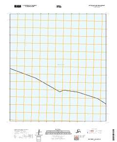
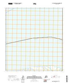
1953 Map of Hooper Bay B-1
USGS Topo · Published 1964About this map
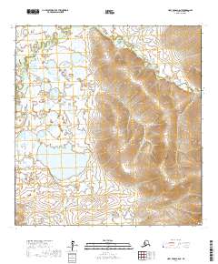
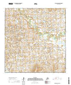
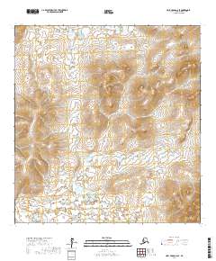
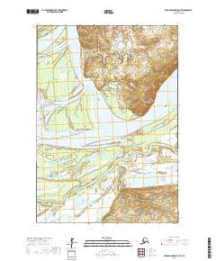
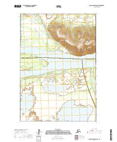
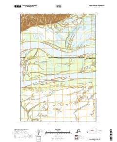
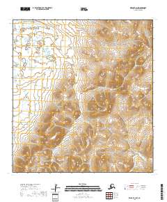
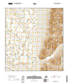
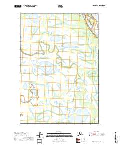
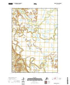
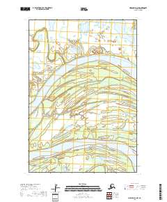
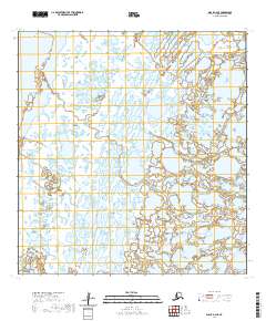
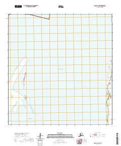
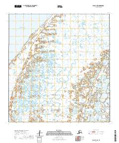
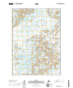
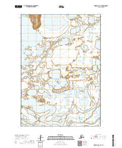
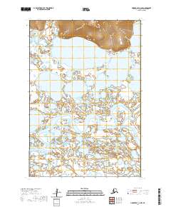
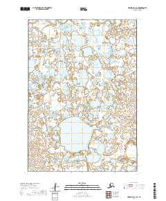
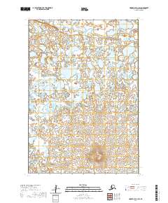
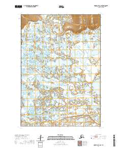
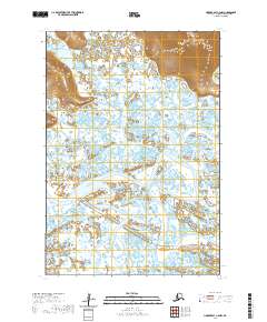
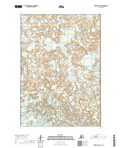
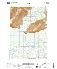
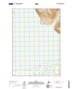
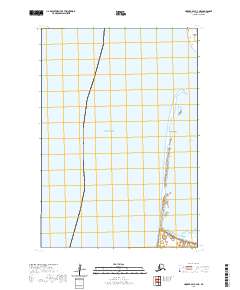
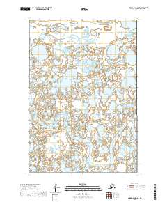
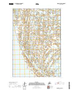
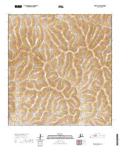
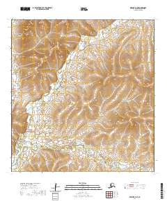
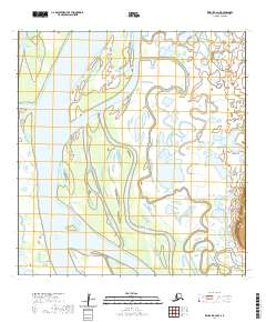
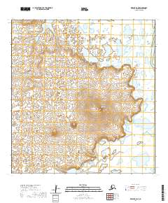
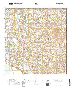
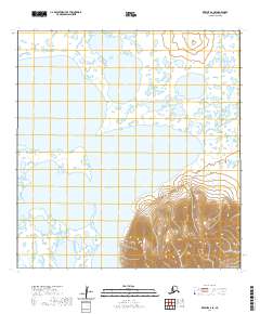
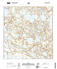
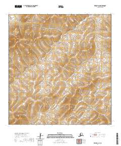
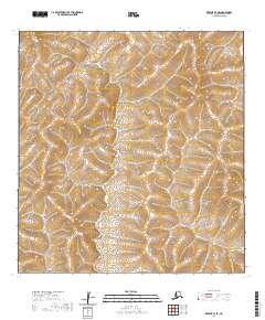
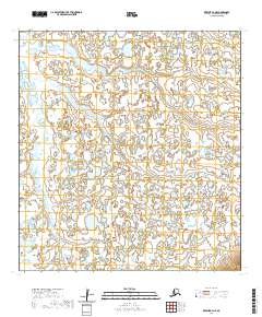
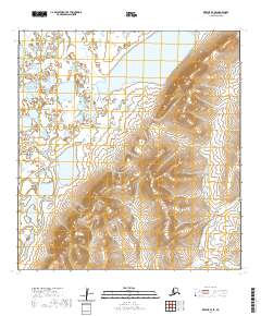
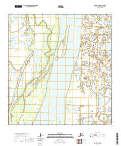
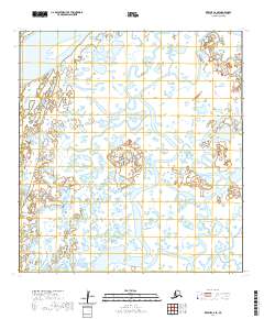
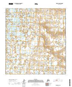
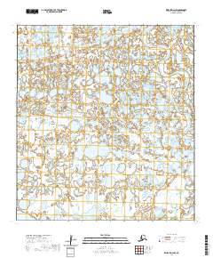
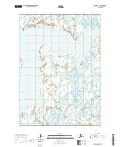
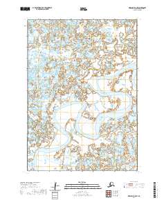
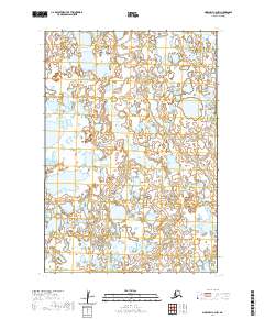
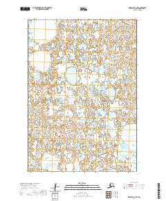
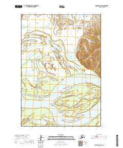
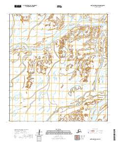
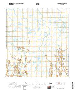
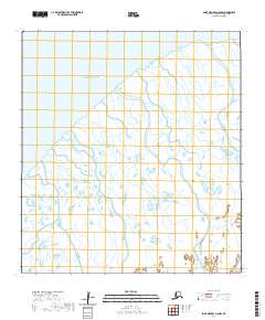
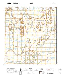
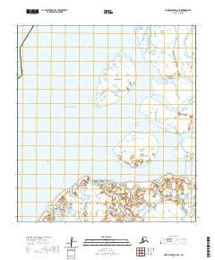
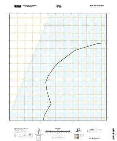
The Clarence Rhode National Wildlife Range Area No 1 dominates this remote landscape, protecting a complex aquatic system of the Yukon-Kuskokwim Delta. The Kashunuk River and Ukalikchik River wind through the terrain, accompanied by lesser-known waterways like Kuyungsik, Aphrewn, and Tungaluk Slough. This environment is characterized by an intricate network of tundra ponds and tidal sloughs, where the transition between land and water is often marked by an Indefinite Boundary. The map reflects a period of systematic aerial photogrammetry by the Army Map Service and the Geological Survey to document one of the most hydrographically dense regions in Alaska. Researchers can trace the meandering paths of the Manokinak River and see the precise survey points established during the early 1950s field annotations.
Find a feature on this map
11 named features on this map. Tap any name to fly to it.
Don’t see what you’re looking for? This feature index may not catch every label — zoom into the map to look around manually.
Map Details
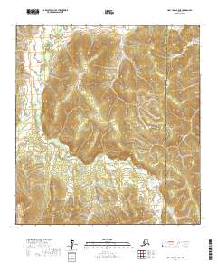
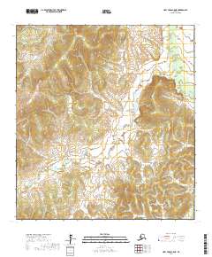
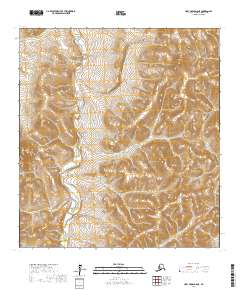
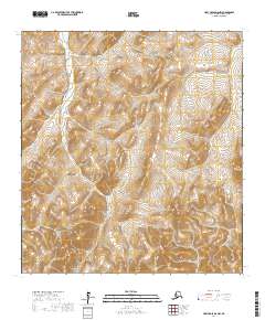
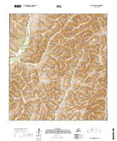
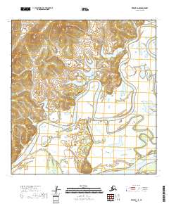
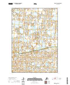
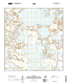
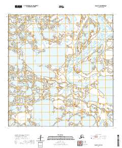
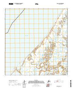
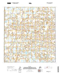
Editions of this 1953 Hooper Bay B-1 Map
This is the sole edition of this map. No revisions or reprints were ever made.
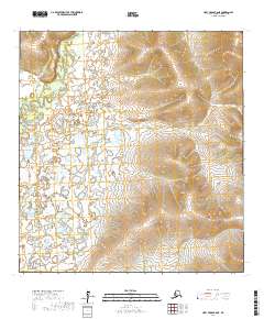
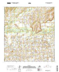
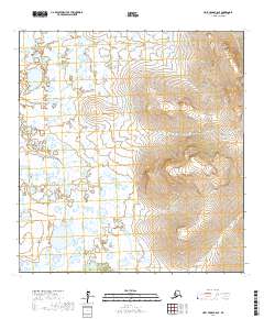
Historical Maps of Unorganized Borough Through Time
411 maps found

1951 Black
Kusilvak Borough, AK

1951 Holy Cross A-5
Kusilvak Borough, AK

1951 St Michael
Kusilvak Borough, AK

1952 Black A-1
Kusilvak Borough, AK

1952 Black A-2
Kusilvak Borough, AK

1952 Black B-1
Kusilvak Borough, AK

1952 Black C-1
Kusilvak Borough, AK

1952 Holy Cross A-5
Kusilvak Borough, AK

1952 Holy Cross A-6
Kusilvak Borough, AK

1952 Holy Cross B-5
Kusilvak Borough, AK

1952 Holy Cross B-6
Kusilvak Borough, AK

1952 Holy Cross C-5
Kusilvak Borough, AK

1952 Holy Cross C-6
Kusilvak Borough, AK

1952 Holy Cross D-5
Kusilvak Borough, AK

1952 Holy Cross D-6
Kusilvak Borough, AK

1952 Hooper Bay A-2
Kusilvak Borough, AK

1952 Hooper Bay B-3
Kusilvak Borough, AK

1952 Hooper Bay C-1
Kusilvak Borough, AK

1952 Hooper Bay C-3
Kusilvak Borough, AK

1952 Hooper Bay C-4
Kusilvak Borough, AK

1952 Hooper Bay D-1
Kusilvak Borough, AK

1952 Hooper Bay D-2
Kusilvak Borough, AK

1952 Kwiguk A-1
Kusilvak Borough, AK

1952 Kwiguk A-2
Kusilvak Borough, AK

1952 Kwiguk A-3
Kusilvak Borough, AK

1952 Kwiguk A-4
Kusilvak Borough, AK

1952 Kwiguk A-5
Kusilvak Borough, AK

1952 Kwiguk A-6
Kusilvak Borough, AK

1952 Kwiguk B-1
Kusilvak Borough, AK

1952 Kwiguk B-2
Kusilvak Borough, AK
1952 Kwiguk B-3
Kusilvak Borough, AK

1952 Kwiguk B-4
Kusilvak Borough, AK

1952 Kwiguk B-5
Kusilvak Borough, AK

1952 Kwiguk B-6
Kusilvak Borough, AK

1952 Kwiguk C-1
Kusilvak Borough, AK

1952 Kwiguk C-2
Kusilvak Borough, AK

1952 Kwiguk C-3
Kusilvak Borough, AK

1952 Kwiguk C-4
Kusilvak Borough, AK

1952 Kwiguk C-5
Kusilvak Borough, AK

1952 Kwiguk C-6
Kusilvak Borough, AK

1952 Kwiguk D-1
Kusilvak Borough, AK

1952 Kwiguk D-2
Kusilvak Borough, AK

1952 Kwiguk D-3
Kusilvak Borough, AK

1952 Kwiguk D-4
Kusilvak Borough, AK

1952 Kwiguk D-5
Kusilvak Borough, AK

1952 Kwiguk D-6
Kusilvak Borough, AK

1952 Kwiguk
Kusilvak Borough, AK

1952 Marshall C-1
Kusilvak Borough, AK

1952 Marshall C-5
Kusilvak Borough, AK

1952 Marshall C-6
Kusilvak Borough, AK

1952 Marshall C-7
Kusilvak Borough, AK

1952 Marshall C-8
Kusilvak Borough, AK

1952 Marshall D-1
Kusilvak Borough, AK

1952 Marshall D-2
Kusilvak Borough, AK

1952 Marshall D-3
Kusilvak Borough, AK

1952 Marshall D-4
Kusilvak Borough, AK

1952 Marshall D-5
Kusilvak Borough, AK

1952 Marshall D-6
Kusilvak Borough, AK

1952 Marshall D-7
Kusilvak Borough, AK

1952 Marshall D-8
Kusilvak Borough, AK

1952 Russian Mission C-7
Kusilvak Borough, AK

1952 Russian Mission C-8
Kusilvak Borough, AK

1952 Russian Mission D-5
Kusilvak Borough, AK

1952 Russian Mission D-6
Kusilvak Borough, AK

1952 Russian Mission D-7
Kusilvak Borough, AK

1952 Russian Mission D-8
Kusilvak Borough, AK

1952 Saint Michael A-1
Kusilvak Borough, AK

1952 Saint Michael A-2
Kusilvak Borough, AK

1952 Saint Michael A-3
Kusilvak Borough, AK

1952 Saint Michael A-4
Kusilvak Borough, AK

1952 Saint Michael A-5
Kusilvak Borough, AK

1952 Saint Michael A-6
Kusilvak Borough, AK

1952 St Michael
Kusilvak Borough, AK
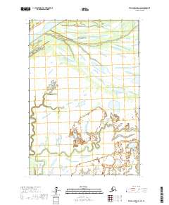
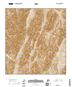
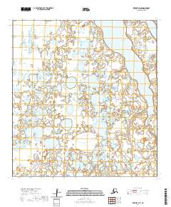
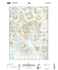
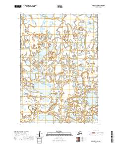
1953 Hooper Bay B-1
Kusilvak Borough, AK

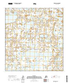
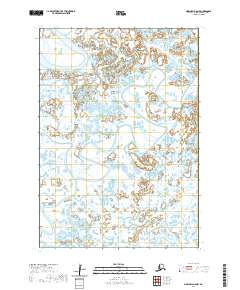
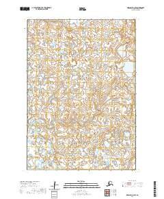
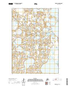
1953 Hooper Bay B-2
Kusilvak Borough, AK

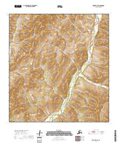
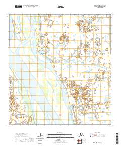
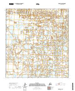
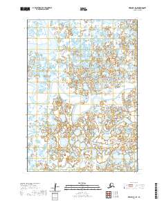
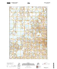
1953 Hooper Bay C-2
Kusilvak Borough, AK

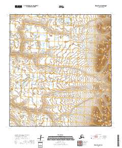
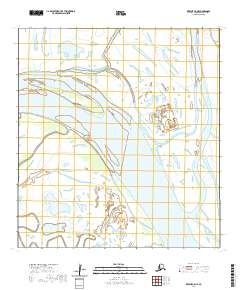
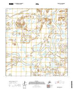
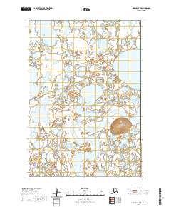
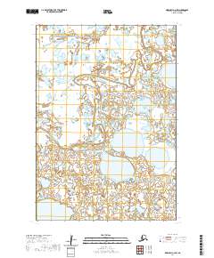
1953 Hooper Bay D-3
Kusilvak Borough, AK

1953 Marshall B-5
Kusilvak Borough, AK

1953 Marshall B-6
Kusilvak Borough, AK

1953 Marshall B-7
Kusilvak Borough, AK

1953 Marshall B-8
Kusilvak Borough, AK

1954 Hooper Bay A-1
Kusilvak Borough, AK

1954 Marshall A-7
Kusilvak Borough, AK

1954 Marshall A-8
Kusilvak Borough, AK

1954 Marshall C-2
Kusilvak Borough, AK

1954 Marshall C-3
Kusilvak Borough, AK

1954 Marshall C-4
Kusilvak Borough, AK

1957 Marshall B-7
Kusilvak Borough, AK

1964 St. Michael
Kusilvak Borough, AK
2017 Holy Cross A-5 NE
Kusilvak Borough, AK
2017 Holy Cross A-5 NW
Kusilvak Borough, AK
2017 Holy Cross A-5 SE
Kusilvak Borough, AK
2017 Holy Cross A-5 SW
Kusilvak Borough, AK
2017 Holy Cross A-6 NE
Kusilvak Borough, AK
2017 Holy Cross A-6 NW
Kusilvak Borough, AK
2017 Holy Cross A-6 SE
Kusilvak Borough, AK
2017 Holy Cross A-6 SW
Kusilvak Borough, AK
2017 Holy Cross B-5 NE
Kusilvak Borough, AK
2017 Holy Cross B-5 NW
Kusilvak Borough, AK
2017 Holy Cross B-5 SE
Kusilvak Borough, AK
2017 Holy Cross B-5 SW
Kusilvak Borough, AK
2017 Holy Cross B-6 NE
Kusilvak Borough, AK
2017 Holy Cross B-6 NW
Kusilvak Borough, AK
2017 Holy Cross B-6 SE
Kusilvak Borough, AK
2017 Holy Cross B-6 SW
Kusilvak Borough, AK
2017 Holy Cross C-5 NE
Kusilvak Borough, AK
2017 Holy Cross C-5 NW
Kusilvak Borough, AK
2017 Holy Cross C-5 SE
Kusilvak Borough, AK
2017 Holy Cross C-5 SW
Kusilvak Borough, AK
2017 Holy Cross C-6 NE
Kusilvak Borough, AK
2017 Holy Cross C-6 NW
Kusilvak Borough, AK
2017 Holy Cross C-6 SE
Kusilvak Borough, AK
2017 Holy Cross C-6 SW
Kusilvak Borough, AK
2017 Holy Cross D-5 NE
Kusilvak Borough, AK
2017 Holy Cross D-5 NW
Kusilvak Borough, AK
2017 Holy Cross D-5 SE
Kusilvak Borough, AK
2017 Holy Cross D-5 SW
Kusilvak Borough, AK
2017 Holy Cross D-6 NE
Kusilvak Borough, AK
2017 Holy Cross D-6 NW
Kusilvak Borough, AK
2017 Holy Cross D-6 SE
Kusilvak Borough, AK
2017 Holy Cross D-6 SW
Kusilvak Borough, AK
2017 Russian Mission C-6 NE
Kusilvak Borough, AK
2017 Russian Mission C-6 NW
Kusilvak Borough, AK
2017 Russian Mission C-7 NE
Kusilvak Borough, AK
2017 Russian Mission C-7 NW
Kusilvak Borough, AK
2017 Russian Mission C-7 SW
Kusilvak Borough, AK
2017 Russian Mission C-8 NE
Kusilvak Borough, AK
2017 Russian Mission C-8 NW
Kusilvak Borough, AK
2017 Russian Mission C-8 SE
Kusilvak Borough, AK
2017 Russian Mission C-8 SW
Kusilvak Borough, AK
2017 Russian Mission D-5 NE
Kusilvak Borough, AK
2017 Russian Mission D-5 NW
Kusilvak Borough, AK
2017 Russian Mission D-5 SE
Kusilvak Borough, AK
2017 Russian Mission D-5 SW
Kusilvak Borough, AK
2017 Russian Mission D-6 NE
Kusilvak Borough, AK
2017 Russian Mission D-6 NW
Kusilvak Borough, AK
2017 Russian Mission D-6 SE
Kusilvak Borough, AK
2017 Russian Mission D-6 SW
Kusilvak Borough, AK
2017 Russian Mission D-7 NE
Kusilvak Borough, AK
2017 Russian Mission D-7 NW
Kusilvak Borough, AK
2017 Russian Mission D-7 SE
Kusilvak Borough, AK
2017 Russian Mission D-7 SW
Kusilvak Borough, AK
2017 Russian Mission D-8 NE
Kusilvak Borough, AK
2017 Russian Mission D-8 NW
Kusilvak Borough, AK
2017 Russian Mission D-8 SE
Kusilvak Borough, AK

2017 Russian Mission D-8 SW
Kusilvak Borough, AK
2017 Saint Michael A-1 NW
Kusilvak Borough, AK
2017 Saint Michael A-1 SE
Kusilvak Borough, AK
2017 Saint Michael A-1 SW
Kusilvak Borough, AK

2017 Saint Michael A-2 NE
Kusilvak Borough, AK
2017 Saint Michael A-2 NW
Kusilvak Borough, AK
2017 Saint Michael A-2 SE
Kusilvak Borough, AK
2017 Saint Michael A-2 SW
Kusilvak Borough, AK
2018 Kwiguk A-1 NE
Kusilvak Borough, AK
2018 Kwiguk A-1 NW
Kusilvak Borough, AK
2018 Kwiguk A-1 SE
Kusilvak Borough, AK
2018 Kwiguk A-1 SW
Kusilvak Borough, AK
2018 Kwiguk A-2 NE
Kusilvak Borough, AK
2018 Kwiguk A-2 NW
Kusilvak Borough, AK
2018 Kwiguk A-2 SE
Kusilvak Borough, AK
2018 Kwiguk A-2 SW
Kusilvak Borough, AK
2018 Kwiguk B-1 NE
Kusilvak Borough, AK
2018 Kwiguk B-1 NW
Kusilvak Borough, AK
2018 Kwiguk B-1 SE
Kusilvak Borough, AK
2018 Kwiguk B-1 SW
Kusilvak Borough, AK
2018 Kwiguk B-2 NE
Kusilvak Borough, AK
2018 Kwiguk B-2 NW
Kusilvak Borough, AK
2018 Kwiguk B-2 SE
Kusilvak Borough, AK
2018 Kwiguk B-2 SW
Kusilvak Borough, AK
2018 Kwiguk C-1 NE
Kusilvak Borough, AK
2018 Kwiguk C-1 NW
Kusilvak Borough, AK
2018 Kwiguk C-1 SE
Kusilvak Borough, AK
2018 Kwiguk C-1 SW
Kusilvak Borough, AK
2018 Kwiguk C-2 NE
Kusilvak Borough, AK
2018 Kwiguk C-2 NW
Kusilvak Borough, AK
2018 Kwiguk C-2 SE
Kusilvak Borough, AK
2018 Kwiguk C-2 SW
Kusilvak Borough, AK
2018 Kwiguk D-1 NE
Kusilvak Borough, AK
2018 Kwiguk D-1 NW
Kusilvak Borough, AK
2018 Kwiguk D-1 SE
Kusilvak Borough, AK
2018 Kwiguk D-1 SW
Kusilvak Borough, AK

2018 Kwiguk D-2 NE
Kusilvak Borough, AK
2018 Kwiguk D-2 NW
Kusilvak Borough, AK
2018 Kwiguk D-2 SE
Kusilvak Borough, AK
2018 Kwiguk D-2 SW
Kusilvak Borough, AK
2018 Marshall C-1 NE
Kusilvak Borough, AK
2018 Marshall C-1 NW
Kusilvak Borough, AK
2018 Marshall C-1 SE
Kusilvak Borough, AK
2018 Marshall C-1 SW
Kusilvak Borough, AK
2018 Marshall C-2 NE
Kusilvak Borough, AK
2018 Marshall C-2 NW
Kusilvak Borough, AK
2018 Marshall C-2 SE
Kusilvak Borough, AK
2018 Marshall C-2 SW
Kusilvak Borough, AK
2018 Marshall C-3 NE
Kusilvak Borough, AK
2018 Marshall C-3 SE
Kusilvak Borough, AK

2018 Marshall D-1 NE
Kusilvak Borough, AK
2018 Marshall D-1 NW
Kusilvak Borough, AK

2018 Marshall D-1 SE
Kusilvak Borough, AK
2018 Marshall D-1 SW
Kusilvak Borough, AK
2018 Marshall D-2 NE
Kusilvak Borough, AK
2018 Marshall D-2 NW
Kusilvak Borough, AK
2018 Marshall D-2 SE
Kusilvak Borough, AK
2018 Marshall D-2 SW
Kusilvak Borough, AK

2018 Marshall D-3 NE
Kusilvak Borough, AK
2018 Marshall D-3 SE
Kusilvak Borough, AK
2020 Black A-1 NE
Kusilvak Borough, AK
2020 Black A-1 NW
Kusilvak Borough, AK
2020 Black A-1 SE
Kusilvak Borough, AK
2020 Black A-1 SW
Kusilvak Borough, AK
2020 Black A-2 NE
Kusilvak Borough, AK
2020 Black A-2 OE W SE
Kusilvak Borough, AK
2020 Black A-2 SE
Kusilvak Borough, AK
2020 Black A-2 SW
Kusilvak Borough, AK
2020 Black B-1 NE
Kusilvak Borough, AK
2020 Black B-1 NW
Kusilvak Borough, AK
2020 Black B-1 OE W SE
Kusilvak Borough, AK
2020 Black B-1 SE
Kusilvak Borough, AK

2020 Black B-1 SW
Kusilvak Borough, AK
2020 Black C-1 SE
Kusilvak Borough, AK
2020 Hooper Bay A-1 NE
Kusilvak Borough, AK
2020 Hooper Bay A-1 NW
Kusilvak Borough, AK
2020 Hooper Bay A-1 SE
Kusilvak Borough, AK
2020 Hooper Bay A-1 SW
Kusilvak Borough, AK
2020 Hooper Bay A-2 NE
Kusilvak Borough, AK
2020 Hooper Bay A-2 NW
Kusilvak Borough, AK
2020 Hooper Bay A-2 SE
Kusilvak Borough, AK
2020 Hooper Bay A-2 SW
Kusilvak Borough, AK
2020 Hooper Bay B-1 NE
Kusilvak Borough, AK
2020 Hooper Bay B-1 NW
Kusilvak Borough, AK
2020 Hooper Bay B-1 SE
Kusilvak Borough, AK
2020 Hooper Bay B-1 SW
Kusilvak Borough, AK

2020 Hooper Bay B-2 NE
Kusilvak Borough, AK
2020 Hooper Bay B-2 NW
Kusilvak Borough, AK
2020 Hooper Bay B-2 SE
Kusilvak Borough, AK
2020 Hooper Bay B-2 SW
Kusilvak Borough, AK
2020 Hooper Bay B-3 NE
Kusilvak Borough, AK

2020 Hooper Bay B-3 NW
Kusilvak Borough, AK
2020 Hooper Bay B-3 SE
Kusilvak Borough, AK
2020 Hooper Bay C-1 NE
Kusilvak Borough, AK
2020 Hooper Bay C-1 NW
Kusilvak Borough, AK
2020 Hooper Bay C-1 SE
Kusilvak Borough, AK
2020 Hooper Bay C-1 SW
Kusilvak Borough, AK
2020 Hooper Bay C-2 NE
Kusilvak Borough, AK
2020 Hooper Bay C-2 NW
Kusilvak Borough, AK
2020 Hooper Bay C-2 SE
Kusilvak Borough, AK

2020 Hooper Bay C-2 SW
Kusilvak Borough, AK
2020 Hooper Bay C-3 NE
Kusilvak Borough, AK
2020 Hooper Bay C-3 NW
Kusilvak Borough, AK

2020 Hooper Bay C-3 SE
Kusilvak Borough, AK

2020 Hooper Bay C-3 SW
Kusilvak Borough, AK
2020 Hooper Bay C-4 NE
Kusilvak Borough, AK

2020 Hooper Bay C-4 SE
Kusilvak Borough, AK
2020 Hooper Bay D-1 NE
Kusilvak Borough, AK
2020 Hooper Bay D-1 NW
Kusilvak Borough, AK
2020 Hooper Bay D-1 SE
Kusilvak Borough, AK
2020 Hooper Bay D-1 SW
Kusilvak Borough, AK
2020 Hooper Bay D-2 NE
Kusilvak Borough, AK
2020 Hooper Bay D-2 NW
Kusilvak Borough, AK
2020 Hooper Bay D-2 SE
Kusilvak Borough, AK

2020 Hooper Bay D-2 SW
Kusilvak Borough, AK
2020 Hooper Bay D-3 NE
Kusilvak Borough, AK
2020 Hooper Bay D-3 NW
Kusilvak Borough, AK
2020 Hooper Bay D-3 OE W SE
Kusilvak Borough, AK
2020 Hooper Bay D-3 SE
Kusilvak Borough, AK
2020 Hooper Bay D-3 SW
Kusilvak Borough, AK
2020 Kwiguk A-3 NE
Kusilvak Borough, AK
2020 Kwiguk A-3 NW
Kusilvak Borough, AK

2020 Kwiguk A-3 SE
Kusilvak Borough, AK

2020 Kwiguk A-3 SW
Kusilvak Borough, AK
2020 Kwiguk A-4 NE
Kusilvak Borough, AK
2020 Kwiguk A-4 NW
Kusilvak Borough, AK

2020 Kwiguk A-4 SE
Kusilvak Borough, AK

2020 Kwiguk A-4 SW
Kusilvak Borough, AK
2020 Kwiguk A-5 NE
Kusilvak Borough, AK
2020 Kwiguk A-5 NW
Kusilvak Borough, AK
2020 Kwiguk A-5 SE
Kusilvak Borough, AK
2020 Kwiguk A-5 SW
Kusilvak Borough, AK
2020 Kwiguk A-6 NE
Kusilvak Borough, AK

2020 Kwiguk A-6 NW
Kusilvak Borough, AK
2020 Kwiguk A-6 SE
Kusilvak Borough, AK
2020 Kwiguk A-6 SW
Kusilvak Borough, AK
2020 Kwiguk B-3 NE
Kusilvak Borough, AK

2020 Kwiguk B-3 NW
Kusilvak Borough, AK
2020 Kwiguk B-3 SE
Kusilvak Borough, AK
2020 Kwiguk B-3 SW
Kusilvak Borough, AK
2020 Kwiguk B-4 NE
Kusilvak Borough, AK

2020 Kwiguk B-4 NW
Kusilvak Borough, AK
2020 Kwiguk B-4 SE
Kusilvak Borough, AK
2020 Kwiguk B-4 SW
Kusilvak Borough, AK
2020 Kwiguk B-5 NE
Kusilvak Borough, AK
2020 Kwiguk B-5 NW
Kusilvak Borough, AK
2020 Kwiguk B-5 SE
Kusilvak Borough, AK
2020 Kwiguk B-5 SW
Kusilvak Borough, AK
2020 Kwiguk B-6 NE
Kusilvak Borough, AK

2020 Kwiguk B-6 NW
Kusilvak Borough, AK
2020 Kwiguk B-6 SE
Kusilvak Borough, AK
2020 Kwiguk B-6 SW
Kusilvak Borough, AK
2020 Kwiguk C-3 NE
Kusilvak Borough, AK
2020 Kwiguk C-3 NW
Kusilvak Borough, AK
2020 Kwiguk C-3 SE
Kusilvak Borough, AK
2020 Kwiguk C-3 SW
Kusilvak Borough, AK
2020 Kwiguk C-4 NE
Kusilvak Borough, AK
2020 Kwiguk C-4 NW
Kusilvak Borough, AK
2020 Kwiguk C-4 SE
Kusilvak Borough, AK
2020 Kwiguk C-4 SW
Kusilvak Borough, AK
2020 Kwiguk C-5 NE
Kusilvak Borough, AK
2020 Kwiguk C-5 NW
Kusilvak Borough, AK
2020 Kwiguk C-5 SE
Kusilvak Borough, AK
2020 Kwiguk C-5 SW
Kusilvak Borough, AK
2020 Kwiguk C-6 NE
Kusilvak Borough, AK
2020 Kwiguk C-6 NW
Kusilvak Borough, AK
2020 Kwiguk C-6 SE
Kusilvak Borough, AK

2020 Kwiguk C-6 SW
Kusilvak Borough, AK
2020 Kwiguk D-3 NE
Kusilvak Borough, AK
2020 Kwiguk D-3 NW
Kusilvak Borough, AK
2020 Kwiguk D-3 SE
Kusilvak Borough, AK
2020 Kwiguk D-3 SW
Kusilvak Borough, AK
2020 Kwiguk D-4 NE
Kusilvak Borough, AK
2020 Kwiguk D-4 NW
Kusilvak Borough, AK
2020 Kwiguk D-4 SE
Kusilvak Borough, AK
2020 Kwiguk D-4 SW
Kusilvak Borough, AK
2020 Kwiguk D-5 NE
Kusilvak Borough, AK
2020 Kwiguk D-5 NW
Kusilvak Borough, AK
2020 Kwiguk D-5 SE
Kusilvak Borough, AK

2020 Kwiguk D-5 SW
Kusilvak Borough, AK
2020 Kwiguk D-6 NE
Kusilvak Borough, AK
2020 Kwiguk D-6 NW
Kusilvak Borough, AK

2020 Kwiguk D-6 SE
Kusilvak Borough, AK
2020 Kwiguk D-6 SW
Kusilvak Borough, AK
2020 Marshall A-6 NW
Kusilvak Borough, AK
2020 Marshall A-7 NE
Kusilvak Borough, AK
2020 Marshall A-7 NW
Kusilvak Borough, AK
2020 Marshall A-7 SE
Kusilvak Borough, AK
2020 Marshall A-7 SW
Kusilvak Borough, AK
2020 Marshall A-8 NE
Kusilvak Borough, AK
2020 Marshall A-8 NW
Kusilvak Borough, AK
2020 Marshall A-8 SE
Kusilvak Borough, AK
2020 Marshall A-8 SW
Kusilvak Borough, AK
2020 Marshall B-5 NE
Kusilvak Borough, AK
2020 Marshall B-5 NW
Kusilvak Borough, AK
2020 Marshall B-6 NE
Kusilvak Borough, AK
2020 Marshall B-6 NW
Kusilvak Borough, AK
2020 Marshall B-6 SW
Kusilvak Borough, AK
2020 Marshall B-7 NE
Kusilvak Borough, AK
2020 Marshall B-7 NW
Kusilvak Borough, AK
2020 Marshall B-7 SE
Kusilvak Borough, AK
2020 Marshall B-7 SW
Kusilvak Borough, AK
2020 Marshall B-8 NE
Kusilvak Borough, AK
2020 Marshall B-8 NW
Kusilvak Borough, AK
2020 Marshall B-8 SE
Kusilvak Borough, AK
2020 Marshall B-8 SW
Kusilvak Borough, AK
2020 Marshall C-3 NW
Kusilvak Borough, AK
2020 Marshall C-3 SW
Kusilvak Borough, AK
2020 Marshall C-4 NE
Kusilvak Borough, AK
2020 Marshall C-4 NW
Kusilvak Borough, AK
2020 Marshall C-4 SE
Kusilvak Borough, AK
2020 Marshall C-4 SW
Kusilvak Borough, AK
2020 Marshall C-5 NE
Kusilvak Borough, AK
2020 Marshall C-5 NW
Kusilvak Borough, AK
2020 Marshall C-5 SE
Kusilvak Borough, AK
2020 Marshall C-5 SW
Kusilvak Borough, AK
2020 Marshall C-6 NE
Kusilvak Borough, AK
2020 Marshall C-6 NW
Kusilvak Borough, AK
2020 Marshall C-6 SE
Kusilvak Borough, AK
2020 Marshall C-6 SW
Kusilvak Borough, AK
2020 Marshall C-7 NE
Kusilvak Borough, AK
2020 Marshall C-7 NW
Kusilvak Borough, AK
2020 Marshall C-7 SE
Kusilvak Borough, AK
2020 Marshall C-7 SW
Kusilvak Borough, AK
2020 Marshall C-8 NE
Kusilvak Borough, AK
2020 Marshall C-8 NW
Kusilvak Borough, AK
2020 Marshall C-8 SE
Kusilvak Borough, AK
2020 Marshall C-8 SW
Kusilvak Borough, AK
2020 Marshall D-3 NW
Kusilvak Borough, AK
2020 Marshall D-3 SW
Kusilvak Borough, AK
2020 Marshall D-4 NE
Kusilvak Borough, AK
2020 Marshall D-4 NW
Kusilvak Borough, AK

2020 Marshall D-4 SE
Kusilvak Borough, AK
2020 Marshall D-4 SW
Kusilvak Borough, AK
2020 Marshall D-5 NE
Kusilvak Borough, AK
2020 Marshall D-5 NW
Kusilvak Borough, AK
2020 Marshall D-5 SE
Kusilvak Borough, AK
2020 Marshall D-5 SW
Kusilvak Borough, AK
2020 Marshall D-6 NE
Kusilvak Borough, AK
2020 Marshall D-6 NW
Kusilvak Borough, AK
2020 Marshall D-6 SE
Kusilvak Borough, AK

2020 Marshall D-6 SW
Kusilvak Borough, AK
2020 Marshall D-7 NE
Kusilvak Borough, AK
2020 Marshall D-7 NW
Kusilvak Borough, AK
2020 Marshall D-7 SE
Kusilvak Borough, AK
2020 Marshall D-7 SW
Kusilvak Borough, AK
2020 Marshall D-8 NE
Kusilvak Borough, AK
2020 Marshall D-8 NW
Kusilvak Borough, AK
2020 Marshall D-8 SE
Kusilvak Borough, AK
2020 Marshall D-8 SW
Kusilvak Borough, AK
2020 Saint Michael A-3 SE
Kusilvak Borough, AK

2020 Saint Michael A-3 SW
Kusilvak Borough, AK
2020 Saint Michael A-4 NE
Kusilvak Borough, AK
2020 Saint Michael A-4 NW
Kusilvak Borough, AK
2020 Saint Michael A-4 OE N SE
Kusilvak Borough, AK
2020 Saint Michael A-4 OE N SW
Kusilvak Borough, AK

2020 Saint Michael A-4 SE
Kusilvak Borough, AK
2020 Saint Michael A-4 SW
Kusilvak Borough, AK
2020 Saint Michael A-5 NE
Kusilvak Borough, AK
2020 Saint Michael A-5 NW
Kusilvak Borough, AK
2020 Saint Michael A-5 OE N SE
Kusilvak Borough, AK
2020 Saint Michael A-5 SE
Kusilvak Borough, AK

2020 Saint Michael A-5 SW
Kusilvak Borough, AK
2020 Saint Michael A-6 NE
Kusilvak Borough, AK
2020 Saint Michael A-6 SE
Kusilvak Borough, AK
2020 Saint Michael A-6 SW
Kusilvak Borough, AK