
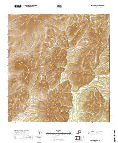
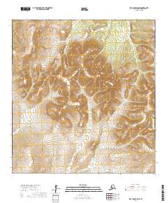
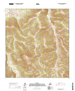
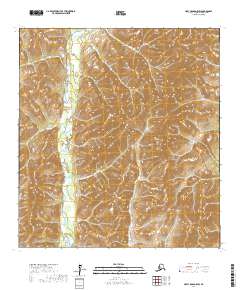
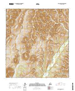
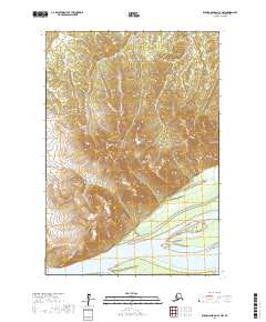
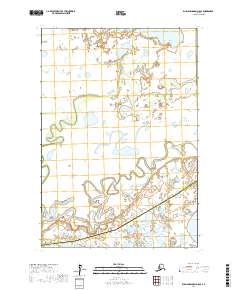
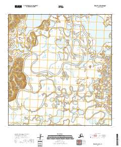
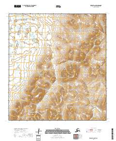
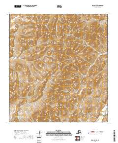
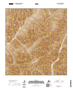
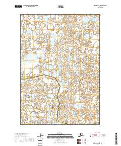
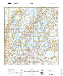
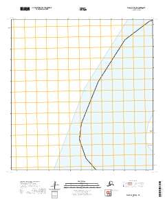
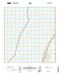
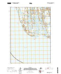
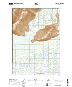
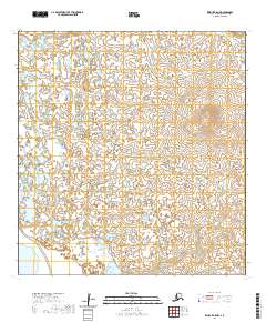
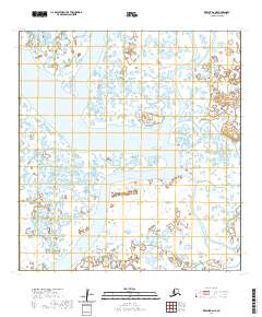
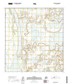
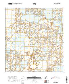
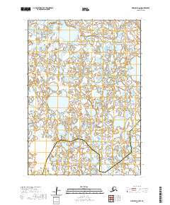
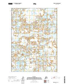
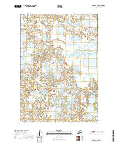
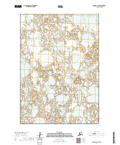
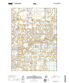
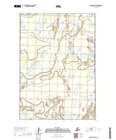
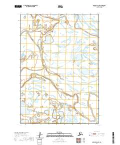
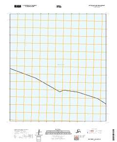
1953 Map of Hooper Bay C-2
USGS Topo · Published 1965About this map
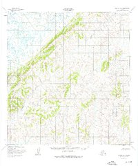
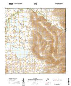
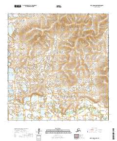
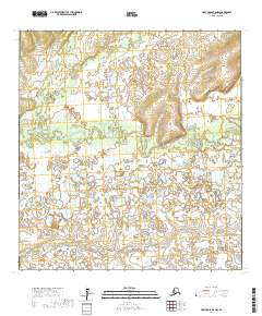
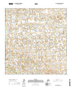
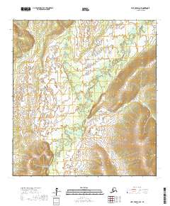
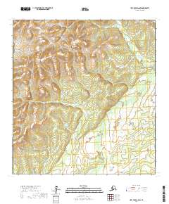
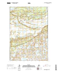
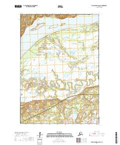
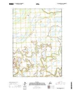
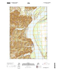
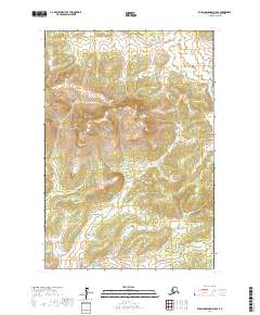
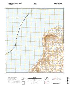
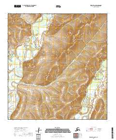
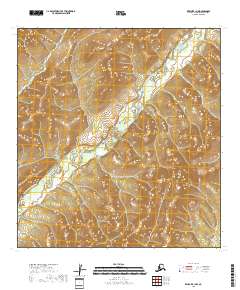
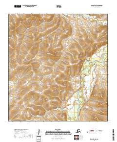
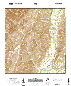
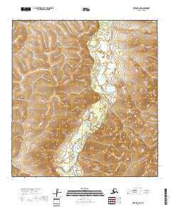
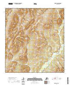
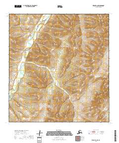
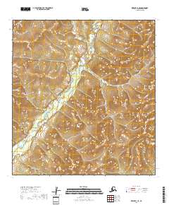
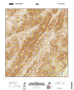
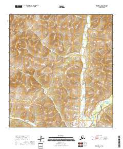
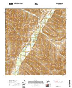
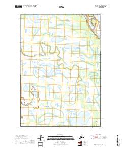
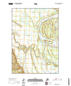
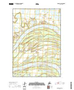
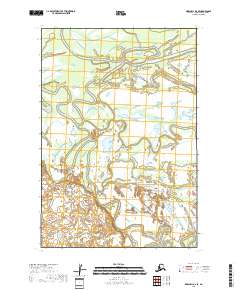
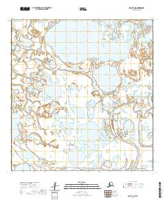
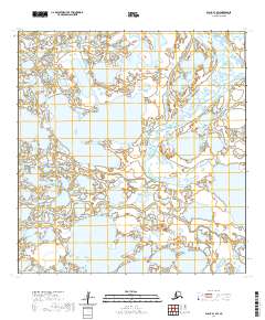
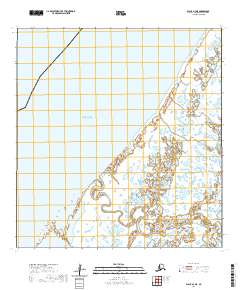
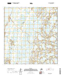
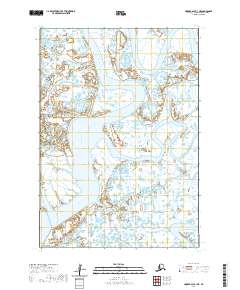
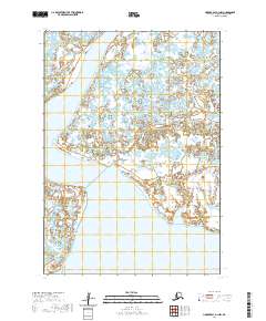
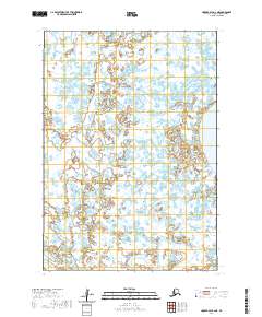
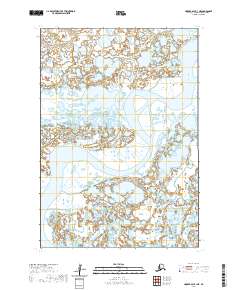
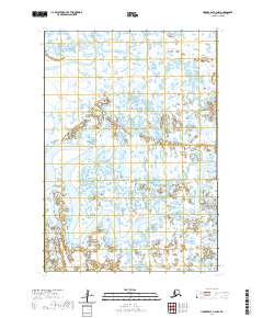
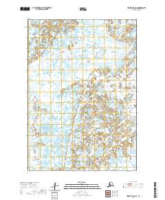
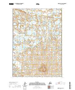
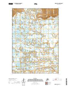
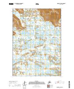
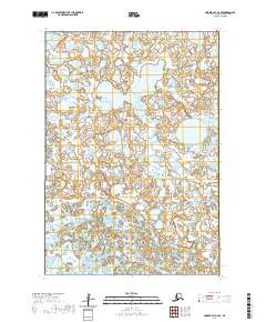
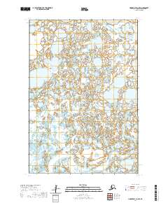
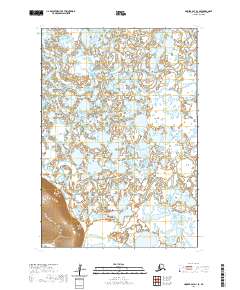
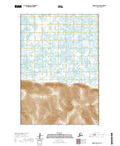
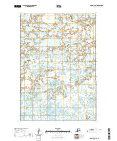
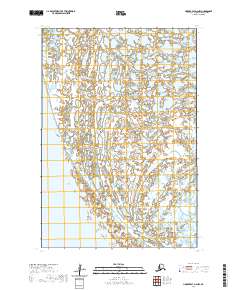
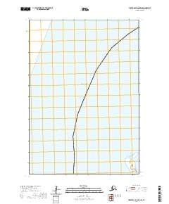
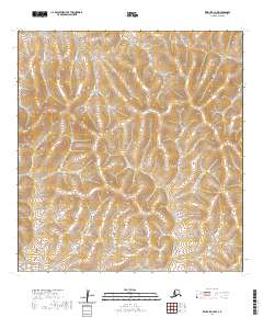
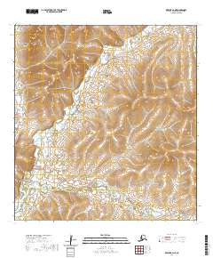
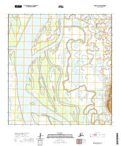
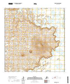
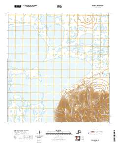
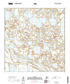
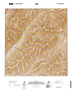
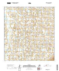
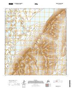
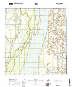
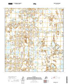
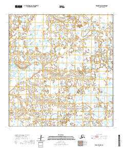
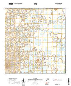
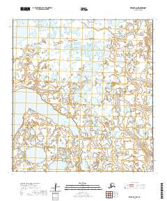
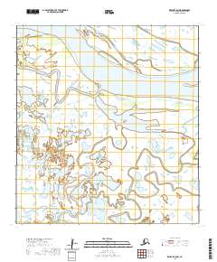
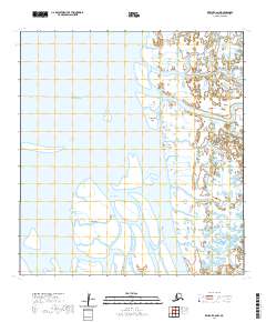
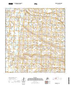
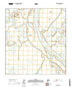
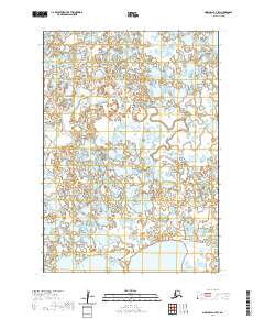
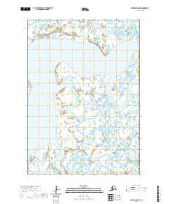
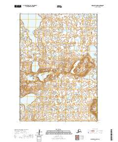
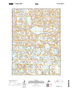
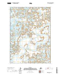
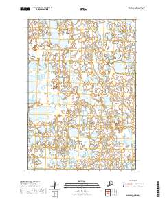
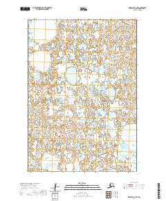
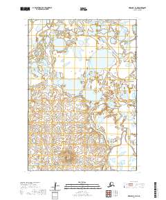
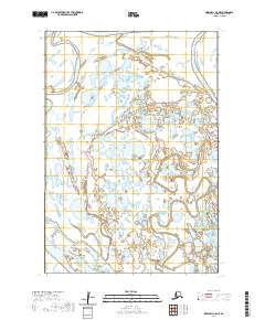
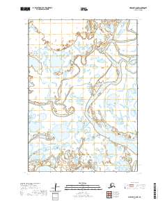
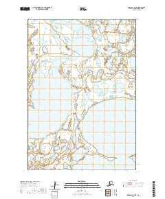
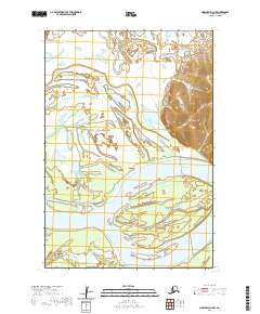
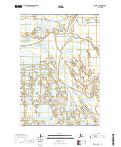
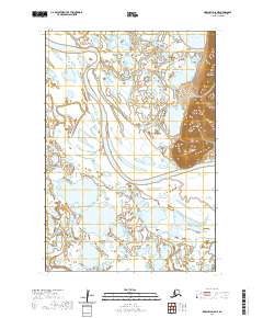
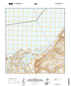
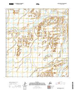
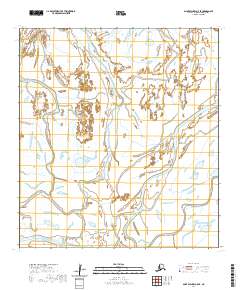
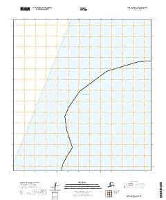
Chevak stands as a central settlement amidst a labyrinthine aquatic landscape on the Yukon-Kuskokwim Delta, as mapped in the early 1950s. The terrain is defined by a dense network of meandering waterways, including the broad Kokechik River and the Kuttak River, which weave through an intricate pattern of tundra ponds and seasonal wetlands. The absence of roads or trails on this survey underscores the reliance on these river systems for transportation and subsistence in this part of the Alaska wilderness.
Find a feature on this map
13 named features on this map. Tap any name to fly to it.
Don’t see what you’re looking for? This feature index may not catch every label — zoom into the map to look around manually.
Map Details
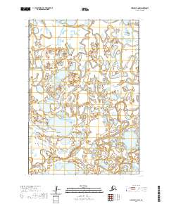
Editions of this 1953 Hooper Bay C-2 Map
This is the sole edition of this map. No revisions or reprints were ever made.
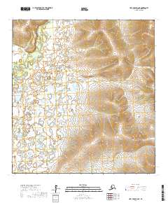
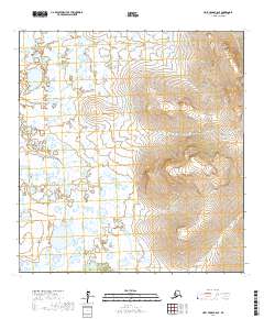
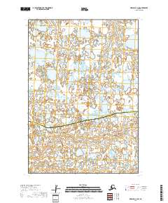
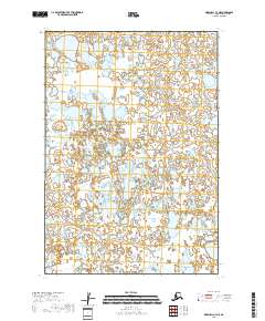
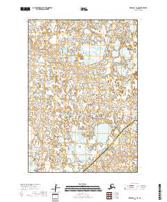
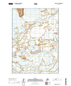
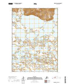
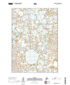
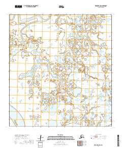
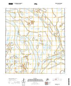
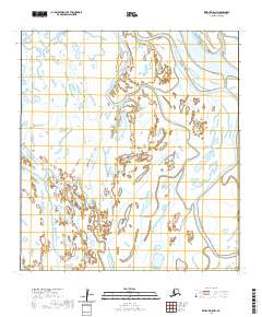
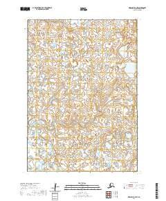
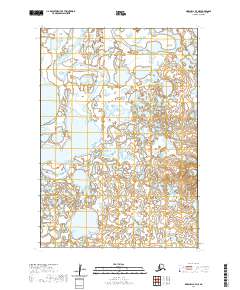
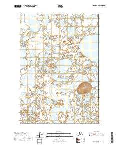
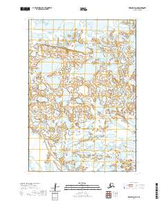
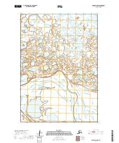
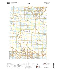
Historical Maps of Chevak Through Time
411 maps found

1951 Black
Kusilvak Borough, AK

1951 Holy Cross A-5
Kusilvak Borough, AK

1951 St Michael
Kusilvak Borough, AK

1952 Black A-1
Kusilvak Borough, AK

1952 Black A-2
Kusilvak Borough, AK

1952 Black B-1
Kusilvak Borough, AK

1952 Black C-1
Kusilvak Borough, AK

1952 Holy Cross A-5
Kusilvak Borough, AK

1952 Holy Cross A-6
Kusilvak Borough, AK

1952 Holy Cross B-5
Kusilvak Borough, AK

1952 Holy Cross B-6
Kusilvak Borough, AK

1952 Holy Cross C-5
Kusilvak Borough, AK

1952 Holy Cross C-6
Kusilvak Borough, AK

1952 Holy Cross D-5
Kusilvak Borough, AK

1952 Holy Cross D-6
Kusilvak Borough, AK

1952 Hooper Bay A-2
Kusilvak Borough, AK

1952 Hooper Bay B-3
Kusilvak Borough, AK

1952 Hooper Bay C-1
Kusilvak Borough, AK

1952 Hooper Bay C-3
Kusilvak Borough, AK

1952 Hooper Bay C-4
Kusilvak Borough, AK

1952 Hooper Bay D-1
Kusilvak Borough, AK

1952 Hooper Bay D-2
Kusilvak Borough, AK

1952 Kwiguk A-1
Kusilvak Borough, AK

1952 Kwiguk A-2
Kusilvak Borough, AK

1952 Kwiguk A-3
Kusilvak Borough, AK

1952 Kwiguk A-4
Kusilvak Borough, AK

1952 Kwiguk A-5
Kusilvak Borough, AK

1952 Kwiguk A-6
Kusilvak Borough, AK

1952 Kwiguk B-1
Kusilvak Borough, AK

1952 Kwiguk B-2
Kusilvak Borough, AK
1952 Kwiguk B-3
Kusilvak Borough, AK

1952 Kwiguk B-4
Kusilvak Borough, AK

1952 Kwiguk B-5
Kusilvak Borough, AK

1952 Kwiguk B-6
Kusilvak Borough, AK

1952 Kwiguk C-1
Kusilvak Borough, AK

1952 Kwiguk C-2
Kusilvak Borough, AK

1952 Kwiguk C-3
Kusilvak Borough, AK

1952 Kwiguk C-4
Kusilvak Borough, AK

1952 Kwiguk C-5
Kusilvak Borough, AK

1952 Kwiguk C-6
Kusilvak Borough, AK

1952 Kwiguk D-1
Kusilvak Borough, AK

1952 Kwiguk D-2
Kusilvak Borough, AK

1952 Kwiguk D-3
Kusilvak Borough, AK

1952 Kwiguk D-4
Kusilvak Borough, AK

1952 Kwiguk D-5
Kusilvak Borough, AK

1952 Kwiguk D-6
Kusilvak Borough, AK

1952 Kwiguk
Kusilvak Borough, AK

1952 Marshall C-1
Kusilvak Borough, AK

1952 Marshall C-5
Kusilvak Borough, AK

1952 Marshall C-6
Kusilvak Borough, AK

1952 Marshall C-7
Kusilvak Borough, AK

1952 Marshall C-8
Kusilvak Borough, AK

1952 Marshall D-1
Kusilvak Borough, AK

1952 Marshall D-2
Kusilvak Borough, AK

1952 Marshall D-3
Kusilvak Borough, AK

1952 Marshall D-4
Kusilvak Borough, AK

1952 Marshall D-5
Kusilvak Borough, AK

1952 Marshall D-6
Kusilvak Borough, AK

1952 Marshall D-7
Kusilvak Borough, AK

1952 Marshall D-8
Kusilvak Borough, AK

1952 Russian Mission C-7
Kusilvak Borough, AK

1952 Russian Mission C-8
Kusilvak Borough, AK

1952 Russian Mission D-5
Kusilvak Borough, AK

1952 Russian Mission D-6
Kusilvak Borough, AK

1952 Russian Mission D-7
Kusilvak Borough, AK

1952 Russian Mission D-8
Kusilvak Borough, AK

1952 Saint Michael A-1
Kusilvak Borough, AK

1952 Saint Michael A-2
Kusilvak Borough, AK

1952 Saint Michael A-3
Kusilvak Borough, AK

1952 Saint Michael A-4
Kusilvak Borough, AK

1952 Saint Michael A-5
Kusilvak Borough, AK

1952 Saint Michael A-6
Kusilvak Borough, AK

1952 St Michael
Kusilvak Borough, AK

1953 Hooper Bay B-1
Kusilvak Borough, AK

1953 Hooper Bay B-2
Kusilvak Borough, AK
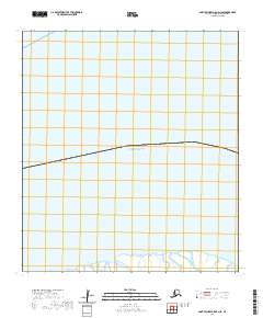
1953 Hooper Bay C-2
Kusilvak Borough, AK

1953 Hooper Bay D-3
Kusilvak Borough, AK

1953 Marshall B-5
Kusilvak Borough, AK

1953 Marshall B-6
Kusilvak Borough, AK

1953 Marshall B-7
Kusilvak Borough, AK

1953 Marshall B-8
Kusilvak Borough, AK

1954 Hooper Bay A-1
Kusilvak Borough, AK

1954 Marshall A-7
Kusilvak Borough, AK

1954 Marshall A-8
Kusilvak Borough, AK

1954 Marshall C-2
Kusilvak Borough, AK

1954 Marshall C-3
Kusilvak Borough, AK

1954 Marshall C-4
Kusilvak Borough, AK

1957 Marshall B-7
Kusilvak Borough, AK

1964 St. Michael
Kusilvak Borough, AK
2017 Holy Cross A-5 NE
Kusilvak Borough, AK
2017 Holy Cross A-5 NW
Kusilvak Borough, AK
2017 Holy Cross A-5 SE
Kusilvak Borough, AK
2017 Holy Cross A-5 SW
Kusilvak Borough, AK
2017 Holy Cross A-6 NE
Kusilvak Borough, AK
2017 Holy Cross A-6 NW
Kusilvak Borough, AK
2017 Holy Cross A-6 SE
Kusilvak Borough, AK
2017 Holy Cross A-6 SW
Kusilvak Borough, AK
2017 Holy Cross B-5 NE
Kusilvak Borough, AK
2017 Holy Cross B-5 NW
Kusilvak Borough, AK
2017 Holy Cross B-5 SE
Kusilvak Borough, AK
2017 Holy Cross B-5 SW
Kusilvak Borough, AK
2017 Holy Cross B-6 NE
Kusilvak Borough, AK
2017 Holy Cross B-6 NW
Kusilvak Borough, AK
2017 Holy Cross B-6 SE
Kusilvak Borough, AK
2017 Holy Cross B-6 SW
Kusilvak Borough, AK
2017 Holy Cross C-5 NE
Kusilvak Borough, AK
2017 Holy Cross C-5 NW
Kusilvak Borough, AK
2017 Holy Cross C-5 SE
Kusilvak Borough, AK
2017 Holy Cross C-5 SW
Kusilvak Borough, AK
2017 Holy Cross C-6 NE
Kusilvak Borough, AK
2017 Holy Cross C-6 NW
Kusilvak Borough, AK
2017 Holy Cross C-6 SE
Kusilvak Borough, AK
2017 Holy Cross C-6 SW
Kusilvak Borough, AK
2017 Holy Cross D-5 NE
Kusilvak Borough, AK
2017 Holy Cross D-5 NW
Kusilvak Borough, AK
2017 Holy Cross D-5 SE
Kusilvak Borough, AK
2017 Holy Cross D-5 SW
Kusilvak Borough, AK
2017 Holy Cross D-6 NE
Kusilvak Borough, AK
2017 Holy Cross D-6 NW
Kusilvak Borough, AK
2017 Holy Cross D-6 SE
Kusilvak Borough, AK
2017 Holy Cross D-6 SW
Kusilvak Borough, AK
2017 Russian Mission C-6 NE
Kusilvak Borough, AK
2017 Russian Mission C-6 NW
Kusilvak Borough, AK
2017 Russian Mission C-7 NE
Kusilvak Borough, AK
2017 Russian Mission C-7 NW
Kusilvak Borough, AK
2017 Russian Mission C-7 SW
Kusilvak Borough, AK
2017 Russian Mission C-8 NE
Kusilvak Borough, AK
2017 Russian Mission C-8 NW
Kusilvak Borough, AK
2017 Russian Mission C-8 SE
Kusilvak Borough, AK
2017 Russian Mission C-8 SW
Kusilvak Borough, AK
2017 Russian Mission D-5 NE
Kusilvak Borough, AK
2017 Russian Mission D-5 NW
Kusilvak Borough, AK
2017 Russian Mission D-5 SE
Kusilvak Borough, AK
2017 Russian Mission D-5 SW
Kusilvak Borough, AK
2017 Russian Mission D-6 NE
Kusilvak Borough, AK
2017 Russian Mission D-6 NW
Kusilvak Borough, AK
2017 Russian Mission D-6 SE
Kusilvak Borough, AK
2017 Russian Mission D-6 SW
Kusilvak Borough, AK
2017 Russian Mission D-7 NE
Kusilvak Borough, AK
2017 Russian Mission D-7 NW
Kusilvak Borough, AK
2017 Russian Mission D-7 SE
Kusilvak Borough, AK
2017 Russian Mission D-7 SW
Kusilvak Borough, AK
2017 Russian Mission D-8 NE
Kusilvak Borough, AK
2017 Russian Mission D-8 NW
Kusilvak Borough, AK
2017 Russian Mission D-8 SE
Kusilvak Borough, AK

2017 Russian Mission D-8 SW
Kusilvak Borough, AK
2017 Saint Michael A-1 NW
Kusilvak Borough, AK
2017 Saint Michael A-1 SE
Kusilvak Borough, AK
2017 Saint Michael A-1 SW
Kusilvak Borough, AK

2017 Saint Michael A-2 NE
Kusilvak Borough, AK
2017 Saint Michael A-2 NW
Kusilvak Borough, AK
2017 Saint Michael A-2 SE
Kusilvak Borough, AK
2017 Saint Michael A-2 SW
Kusilvak Borough, AK
2018 Kwiguk A-1 NE
Kusilvak Borough, AK
2018 Kwiguk A-1 NW
Kusilvak Borough, AK
2018 Kwiguk A-1 SE
Kusilvak Borough, AK
2018 Kwiguk A-1 SW
Kusilvak Borough, AK
2018 Kwiguk A-2 NE
Kusilvak Borough, AK
2018 Kwiguk A-2 NW
Kusilvak Borough, AK
2018 Kwiguk A-2 SE
Kusilvak Borough, AK
2018 Kwiguk A-2 SW
Kusilvak Borough, AK
2018 Kwiguk B-1 NE
Kusilvak Borough, AK
2018 Kwiguk B-1 NW
Kusilvak Borough, AK
2018 Kwiguk B-1 SE
Kusilvak Borough, AK
2018 Kwiguk B-1 SW
Kusilvak Borough, AK
2018 Kwiguk B-2 NE
Kusilvak Borough, AK
2018 Kwiguk B-2 NW
Kusilvak Borough, AK
2018 Kwiguk B-2 SE
Kusilvak Borough, AK
2018 Kwiguk B-2 SW
Kusilvak Borough, AK
2018 Kwiguk C-1 NE
Kusilvak Borough, AK
2018 Kwiguk C-1 NW
Kusilvak Borough, AK
2018 Kwiguk C-1 SE
Kusilvak Borough, AK
2018 Kwiguk C-1 SW
Kusilvak Borough, AK
2018 Kwiguk C-2 NE
Kusilvak Borough, AK
2018 Kwiguk C-2 NW
Kusilvak Borough, AK
2018 Kwiguk C-2 SE
Kusilvak Borough, AK
2018 Kwiguk C-2 SW
Kusilvak Borough, AK
2018 Kwiguk D-1 NE
Kusilvak Borough, AK
2018 Kwiguk D-1 NW
Kusilvak Borough, AK
2018 Kwiguk D-1 SE
Kusilvak Borough, AK
2018 Kwiguk D-1 SW
Kusilvak Borough, AK

2018 Kwiguk D-2 NE
Kusilvak Borough, AK
2018 Kwiguk D-2 NW
Kusilvak Borough, AK
2018 Kwiguk D-2 SE
Kusilvak Borough, AK
2018 Kwiguk D-2 SW
Kusilvak Borough, AK
2018 Marshall C-1 NE
Kusilvak Borough, AK
2018 Marshall C-1 NW
Kusilvak Borough, AK
2018 Marshall C-1 SE
Kusilvak Borough, AK
2018 Marshall C-1 SW
Kusilvak Borough, AK
2018 Marshall C-2 NE
Kusilvak Borough, AK
2018 Marshall C-2 NW
Kusilvak Borough, AK
2018 Marshall C-2 SE
Kusilvak Borough, AK
2018 Marshall C-2 SW
Kusilvak Borough, AK
2018 Marshall C-3 NE
Kusilvak Borough, AK
2018 Marshall C-3 SE
Kusilvak Borough, AK

2018 Marshall D-1 NE
Kusilvak Borough, AK
2018 Marshall D-1 NW
Kusilvak Borough, AK

2018 Marshall D-1 SE
Kusilvak Borough, AK
2018 Marshall D-1 SW
Kusilvak Borough, AK
2018 Marshall D-2 NE
Kusilvak Borough, AK
2018 Marshall D-2 NW
Kusilvak Borough, AK
2018 Marshall D-2 SE
Kusilvak Borough, AK
2018 Marshall D-2 SW
Kusilvak Borough, AK

2018 Marshall D-3 NE
Kusilvak Borough, AK
2018 Marshall D-3 SE
Kusilvak Borough, AK
2020 Black A-1 NE
Kusilvak Borough, AK
2020 Black A-1 NW
Kusilvak Borough, AK
2020 Black A-1 SE
Kusilvak Borough, AK
2020 Black A-1 SW
Kusilvak Borough, AK
2020 Black A-2 NE
Kusilvak Borough, AK
2020 Black A-2 OE W SE
Kusilvak Borough, AK
2020 Black A-2 SE
Kusilvak Borough, AK
2020 Black A-2 SW
Kusilvak Borough, AK
2020 Black B-1 NE
Kusilvak Borough, AK
2020 Black B-1 NW
Kusilvak Borough, AK
2020 Black B-1 OE W SE
Kusilvak Borough, AK
2020 Black B-1 SE
Kusilvak Borough, AK

2020 Black B-1 SW
Kusilvak Borough, AK
2020 Black C-1 SE
Kusilvak Borough, AK
2020 Hooper Bay A-1 NE
Kusilvak Borough, AK
2020 Hooper Bay A-1 NW
Kusilvak Borough, AK
2020 Hooper Bay A-1 SE
Kusilvak Borough, AK
2020 Hooper Bay A-1 SW
Kusilvak Borough, AK
2020 Hooper Bay A-2 NE
Kusilvak Borough, AK
2020 Hooper Bay A-2 NW
Kusilvak Borough, AK
2020 Hooper Bay A-2 SE
Kusilvak Borough, AK
2020 Hooper Bay A-2 SW
Kusilvak Borough, AK
2020 Hooper Bay B-1 NE
Kusilvak Borough, AK
2020 Hooper Bay B-1 NW
Kusilvak Borough, AK
2020 Hooper Bay B-1 SE
Kusilvak Borough, AK
2020 Hooper Bay B-1 SW
Kusilvak Borough, AK

2020 Hooper Bay B-2 NE
Kusilvak Borough, AK
2020 Hooper Bay B-2 NW
Kusilvak Borough, AK
2020 Hooper Bay B-2 SE
Kusilvak Borough, AK
2020 Hooper Bay B-2 SW
Kusilvak Borough, AK
2020 Hooper Bay B-3 NE
Kusilvak Borough, AK

2020 Hooper Bay B-3 NW
Kusilvak Borough, AK
2020 Hooper Bay B-3 SE
Kusilvak Borough, AK
2020 Hooper Bay C-1 NE
Kusilvak Borough, AK
2020 Hooper Bay C-1 NW
Kusilvak Borough, AK
2020 Hooper Bay C-1 SE
Kusilvak Borough, AK
2020 Hooper Bay C-1 SW
Kusilvak Borough, AK
2020 Hooper Bay C-2 NE
Kusilvak Borough, AK
2020 Hooper Bay C-2 NW
Kusilvak Borough, AK
2020 Hooper Bay C-2 SE
Kusilvak Borough, AK

2020 Hooper Bay C-2 SW
Kusilvak Borough, AK
2020 Hooper Bay C-3 NE
Kusilvak Borough, AK
2020 Hooper Bay C-3 NW
Kusilvak Borough, AK

2020 Hooper Bay C-3 SE
Kusilvak Borough, AK

2020 Hooper Bay C-3 SW
Kusilvak Borough, AK
2020 Hooper Bay C-4 NE
Kusilvak Borough, AK

2020 Hooper Bay C-4 SE
Kusilvak Borough, AK
2020 Hooper Bay D-1 NE
Kusilvak Borough, AK
2020 Hooper Bay D-1 NW
Kusilvak Borough, AK
2020 Hooper Bay D-1 SE
Kusilvak Borough, AK
2020 Hooper Bay D-1 SW
Kusilvak Borough, AK
2020 Hooper Bay D-2 NE
Kusilvak Borough, AK
2020 Hooper Bay D-2 NW
Kusilvak Borough, AK
2020 Hooper Bay D-2 SE
Kusilvak Borough, AK

2020 Hooper Bay D-2 SW
Kusilvak Borough, AK
2020 Hooper Bay D-3 NE
Kusilvak Borough, AK
2020 Hooper Bay D-3 NW
Kusilvak Borough, AK
2020 Hooper Bay D-3 OE W SE
Kusilvak Borough, AK
2020 Hooper Bay D-3 SE
Kusilvak Borough, AK
2020 Hooper Bay D-3 SW
Kusilvak Borough, AK
2020 Kwiguk A-3 NE
Kusilvak Borough, AK
2020 Kwiguk A-3 NW
Kusilvak Borough, AK

2020 Kwiguk A-3 SE
Kusilvak Borough, AK

2020 Kwiguk A-3 SW
Kusilvak Borough, AK
2020 Kwiguk A-4 NE
Kusilvak Borough, AK
2020 Kwiguk A-4 NW
Kusilvak Borough, AK

2020 Kwiguk A-4 SE
Kusilvak Borough, AK

2020 Kwiguk A-4 SW
Kusilvak Borough, AK
2020 Kwiguk A-5 NE
Kusilvak Borough, AK
2020 Kwiguk A-5 NW
Kusilvak Borough, AK
2020 Kwiguk A-5 SE
Kusilvak Borough, AK
2020 Kwiguk A-5 SW
Kusilvak Borough, AK
2020 Kwiguk A-6 NE
Kusilvak Borough, AK

2020 Kwiguk A-6 NW
Kusilvak Borough, AK
2020 Kwiguk A-6 SE
Kusilvak Borough, AK
2020 Kwiguk A-6 SW
Kusilvak Borough, AK
2020 Kwiguk B-3 NE
Kusilvak Borough, AK

2020 Kwiguk B-3 NW
Kusilvak Borough, AK
2020 Kwiguk B-3 SE
Kusilvak Borough, AK
2020 Kwiguk B-3 SW
Kusilvak Borough, AK
2020 Kwiguk B-4 NE
Kusilvak Borough, AK

2020 Kwiguk B-4 NW
Kusilvak Borough, AK
2020 Kwiguk B-4 SE
Kusilvak Borough, AK
2020 Kwiguk B-4 SW
Kusilvak Borough, AK
2020 Kwiguk B-5 NE
Kusilvak Borough, AK
2020 Kwiguk B-5 NW
Kusilvak Borough, AK
2020 Kwiguk B-5 SE
Kusilvak Borough, AK
2020 Kwiguk B-5 SW
Kusilvak Borough, AK
2020 Kwiguk B-6 NE
Kusilvak Borough, AK

2020 Kwiguk B-6 NW
Kusilvak Borough, AK
2020 Kwiguk B-6 SE
Kusilvak Borough, AK
2020 Kwiguk B-6 SW
Kusilvak Borough, AK
2020 Kwiguk C-3 NE
Kusilvak Borough, AK
2020 Kwiguk C-3 NW
Kusilvak Borough, AK
2020 Kwiguk C-3 SE
Kusilvak Borough, AK
2020 Kwiguk C-3 SW
Kusilvak Borough, AK
2020 Kwiguk C-4 NE
Kusilvak Borough, AK
2020 Kwiguk C-4 NW
Kusilvak Borough, AK
2020 Kwiguk C-4 SE
Kusilvak Borough, AK
2020 Kwiguk C-4 SW
Kusilvak Borough, AK
2020 Kwiguk C-5 NE
Kusilvak Borough, AK
2020 Kwiguk C-5 NW
Kusilvak Borough, AK
2020 Kwiguk C-5 SE
Kusilvak Borough, AK
2020 Kwiguk C-5 SW
Kusilvak Borough, AK
2020 Kwiguk C-6 NE
Kusilvak Borough, AK
2020 Kwiguk C-6 NW
Kusilvak Borough, AK
2020 Kwiguk C-6 SE
Kusilvak Borough, AK

2020 Kwiguk C-6 SW
Kusilvak Borough, AK
2020 Kwiguk D-3 NE
Kusilvak Borough, AK
2020 Kwiguk D-3 NW
Kusilvak Borough, AK
2020 Kwiguk D-3 SE
Kusilvak Borough, AK
2020 Kwiguk D-3 SW
Kusilvak Borough, AK
2020 Kwiguk D-4 NE
Kusilvak Borough, AK
2020 Kwiguk D-4 NW
Kusilvak Borough, AK
2020 Kwiguk D-4 SE
Kusilvak Borough, AK
2020 Kwiguk D-4 SW
Kusilvak Borough, AK
2020 Kwiguk D-5 NE
Kusilvak Borough, AK
2020 Kwiguk D-5 NW
Kusilvak Borough, AK
2020 Kwiguk D-5 SE
Kusilvak Borough, AK

2020 Kwiguk D-5 SW
Kusilvak Borough, AK
2020 Kwiguk D-6 NE
Kusilvak Borough, AK
2020 Kwiguk D-6 NW
Kusilvak Borough, AK

2020 Kwiguk D-6 SE
Kusilvak Borough, AK
2020 Kwiguk D-6 SW
Kusilvak Borough, AK
2020 Marshall A-6 NW
Kusilvak Borough, AK
2020 Marshall A-7 NE
Kusilvak Borough, AK
2020 Marshall A-7 NW
Kusilvak Borough, AK
2020 Marshall A-7 SE
Kusilvak Borough, AK
2020 Marshall A-7 SW
Kusilvak Borough, AK
2020 Marshall A-8 NE
Kusilvak Borough, AK
2020 Marshall A-8 NW
Kusilvak Borough, AK
2020 Marshall A-8 SE
Kusilvak Borough, AK
2020 Marshall A-8 SW
Kusilvak Borough, AK
2020 Marshall B-5 NE
Kusilvak Borough, AK
2020 Marshall B-5 NW
Kusilvak Borough, AK
2020 Marshall B-6 NE
Kusilvak Borough, AK
2020 Marshall B-6 NW
Kusilvak Borough, AK
2020 Marshall B-6 SW
Kusilvak Borough, AK
2020 Marshall B-7 NE
Kusilvak Borough, AK
2020 Marshall B-7 NW
Kusilvak Borough, AK
2020 Marshall B-7 SE
Kusilvak Borough, AK
2020 Marshall B-7 SW
Kusilvak Borough, AK
2020 Marshall B-8 NE
Kusilvak Borough, AK
2020 Marshall B-8 NW
Kusilvak Borough, AK
2020 Marshall B-8 SE
Kusilvak Borough, AK
2020 Marshall B-8 SW
Kusilvak Borough, AK
2020 Marshall C-3 NW
Kusilvak Borough, AK
2020 Marshall C-3 SW
Kusilvak Borough, AK
2020 Marshall C-4 NE
Kusilvak Borough, AK
2020 Marshall C-4 NW
Kusilvak Borough, AK
2020 Marshall C-4 SE
Kusilvak Borough, AK
2020 Marshall C-4 SW
Kusilvak Borough, AK
2020 Marshall C-5 NE
Kusilvak Borough, AK
2020 Marshall C-5 NW
Kusilvak Borough, AK
2020 Marshall C-5 SE
Kusilvak Borough, AK
2020 Marshall C-5 SW
Kusilvak Borough, AK
2020 Marshall C-6 NE
Kusilvak Borough, AK
2020 Marshall C-6 NW
Kusilvak Borough, AK
2020 Marshall C-6 SE
Kusilvak Borough, AK
2020 Marshall C-6 SW
Kusilvak Borough, AK
2020 Marshall C-7 NE
Kusilvak Borough, AK
2020 Marshall C-7 NW
Kusilvak Borough, AK
2020 Marshall C-7 SE
Kusilvak Borough, AK
2020 Marshall C-7 SW
Kusilvak Borough, AK
2020 Marshall C-8 NE
Kusilvak Borough, AK
2020 Marshall C-8 NW
Kusilvak Borough, AK
2020 Marshall C-8 SE
Kusilvak Borough, AK
2020 Marshall C-8 SW
Kusilvak Borough, AK
2020 Marshall D-3 NW
Kusilvak Borough, AK
2020 Marshall D-3 SW
Kusilvak Borough, AK
2020 Marshall D-4 NE
Kusilvak Borough, AK
2020 Marshall D-4 NW
Kusilvak Borough, AK

2020 Marshall D-4 SE
Kusilvak Borough, AK
2020 Marshall D-4 SW
Kusilvak Borough, AK
2020 Marshall D-5 NE
Kusilvak Borough, AK
2020 Marshall D-5 NW
Kusilvak Borough, AK
2020 Marshall D-5 SE
Kusilvak Borough, AK
2020 Marshall D-5 SW
Kusilvak Borough, AK
2020 Marshall D-6 NE
Kusilvak Borough, AK
2020 Marshall D-6 NW
Kusilvak Borough, AK
2020 Marshall D-6 SE
Kusilvak Borough, AK

2020 Marshall D-6 SW
Kusilvak Borough, AK
2020 Marshall D-7 NE
Kusilvak Borough, AK
2020 Marshall D-7 NW
Kusilvak Borough, AK
2020 Marshall D-7 SE
Kusilvak Borough, AK
2020 Marshall D-7 SW
Kusilvak Borough, AK
2020 Marshall D-8 NE
Kusilvak Borough, AK
2020 Marshall D-8 NW
Kusilvak Borough, AK
2020 Marshall D-8 SE
Kusilvak Borough, AK
2020 Marshall D-8 SW
Kusilvak Borough, AK
2020 Saint Michael A-3 SE
Kusilvak Borough, AK

2020 Saint Michael A-3 SW
Kusilvak Borough, AK
2020 Saint Michael A-4 NE
Kusilvak Borough, AK
2020 Saint Michael A-4 NW
Kusilvak Borough, AK
2020 Saint Michael A-4 OE N SE
Kusilvak Borough, AK
2020 Saint Michael A-4 OE N SW
Kusilvak Borough, AK

2020 Saint Michael A-4 SE
Kusilvak Borough, AK
2020 Saint Michael A-4 SW
Kusilvak Borough, AK
2020 Saint Michael A-5 NE
Kusilvak Borough, AK
2020 Saint Michael A-5 NW
Kusilvak Borough, AK
2020 Saint Michael A-5 OE N SE
Kusilvak Borough, AK
2020 Saint Michael A-5 SE
Kusilvak Borough, AK

2020 Saint Michael A-5 SW
Kusilvak Borough, AK
2020 Saint Michael A-6 NE
Kusilvak Borough, AK
2020 Saint Michael A-6 SE
Kusilvak Borough, AK
2020 Saint Michael A-6 SW
Kusilvak Borough, AK