
1952 Map of Hooper Bay D-2
USGS Topo · Published 1965About this map
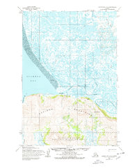
Scammon Bay serves as the primary coastal anchor on this western Alaska landscape, situated where the lowland marshes meet the rising topography. The terrain is sharply divided between the northern marshlands, characterized by a dense network of lakes and the winding Kun River, and the southern heights of the As Kinuk Mountains. This 1952 study captures the area's vital waterways, including the Bar River and Kalomak River, which provide natural corridors through the delta.
Find a feature on this map
18 named features on this map. Tap any name to fly to it.
Don’t see what you’re looking for? This feature index may not catch every label — zoom into the map to look around manually.
Map Details
Editions of this 1952 Hooper Bay D-2 Map
2 editions found
Other maps of this area

1951 · Hooper Bay
USGS Topo · 1:250,000

1951 · Black
USGS Topo · 1:250,000

1952 · Black A-2
USGS Topo · 1:63,360

1952 · Black A-1
USGS Topo · 1:63,360

1952 · Hooper Bay C-3
USGS Topo · 1:63,360
1952 · Hooper Bay D-1
USGS Topo · 1:63,360
1952 · Hooper Bay C-1
USGS Topo · 1:63,360

1953 · Hooper Bay
USGS Topo · 1:250,000

1953 · Hooper Bay C-2
USGS Topo · 1:63,360
1953 · Hooper Bay D-3
USGS Topo · 1:63,360