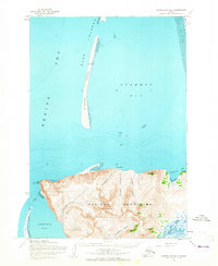
1953 Map of Hooper Bay D-3
USGS Topo · Published 1965About this map
The Askinuk Mountains dominate this coastal survey, rising sharply between the waters of Scammon Bay and Kokechik Bay. At the westernmost edge of the range, Cape Romanzof stands as a prominent sentinel overlooking the Bering Sea, while the inland landscape is defined by the high peak of Towak Mtn and a network of drainages including the Ekashluak River and Lukkeah River.
Find a feature on this map
21 named features on this map. Tap any name to fly to it.
Don’t see what you’re looking for? This feature index may not catch every label — zoom into the map to look around manually.
Map Details
Editions of this 1953 Hooper Bay D-3 Map
2 editions found
Other maps of this area

1951 · Hooper Bay
USGS Topo · 1:250,000

1951 · Black
USGS Topo · 1:250,000

1952 · Black A-2
USGS Topo · 1:63,360
1952 · Hooper Bay C-4
USGS Topo · 1:63,360

1952 · Hooper Bay C-3
USGS Topo · 1:63,360

1952 · Hooper Bay D-2
USGS Topo · 1:63,360

1953 · Hooper Bay
USGS Topo · 1:250,000

1953 · Hooper Bay C-2
USGS Topo · 1:63,360

1964 · Hooper Bay
USGS Topo · 1:250,000
2020 · Hooper Bay C-4 NE
USGS Topo · 1:25,000