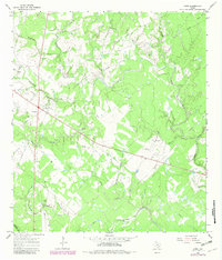
1965 Map of Hope
USGS Topo · Published 1983About this map
The Hope community serves as the primary settlement on this landscape, which is defined by the winding course of the Lavaca River and an intricate network of drainage creeks. Mapping of the area reflects the rural character of Lavaca and De Witt counties during the mid-1960s, showing a transition from traditional land use to industrial activity marked by the presence of a Pumping Sta and scattered Oil Well sites.
Find a feature on this map
20 named features on this map. Tap any name to fly to it.
Don’t see what you’re looking for? This feature index may not catch every label — zoom into the map to look around manually.
Map Details
Editions of this 1965 Hope Map
2 editions found
Other maps of this area

1953 · Seguin
USGS Topo · 1:250,000

1958 · Seguin
USGS Topo · 1:250,000

1962 · Terryville
USGS Topo · 1:24,000

1962 · Hallettsville SE
USGS Topo · 1:24,000

1963 · Fordtran
USGS Topo · 1:24,000

1963 · Sweet Home
USGS Topo · 1:24,000

1964 · Morales
USGS Topo · 1:24,000
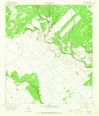
1964 · Navidad
USGS Topo · 1:24,000

1964 · Ezzell
USGS Topo · 1:24,000

1965 · Hope
USGS Topo · 1:24,000