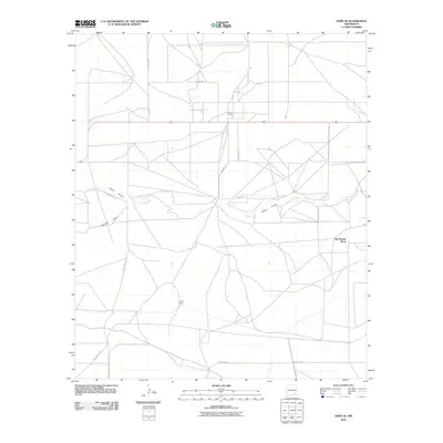
2010 Map of Hope SE
USGS Topo · Published 2010About this map
Old Horner Place and family-held land like Eaton Ranch anchor this high plains landscape in Eddy County, where the topography is defined by seasonal watercourses and an organized grid of rural roads. The area is characterized by the ephemeral drainage patterns of Eagle Creek and Eagle Draw, which are joined by the curiously named Catclaw Draw as they wind across the terrain. These natural features dictated the early settlement patterns, which are now serviced by a network of thoroughfares including Rio Penasco Rd and W Blevins Rd. The layout of County Rd 95 and Colbert Ave suggests a transition from traditional ranching boundaries to a more structured modern rural subdivision or resource management grid. This survey provides a clear view of how land ownership, such as the Laney Ranch, persists alongside the physical legacy of the New Mexico landscape.
Find a feature on this map
13 named features on this map. Tap any name to fly to it.
Don’t see what you’re looking for? This feature index may not catch every label — zoom into the map to look around manually.
Map Details
Editions of this 2010 Hope SE Map
This is the sole edition of this map. No revisions or reprints were ever made.
Other maps of this area

1953 · Espuela
USGS Topo · 1:24,000

1954 · Carlsbad
USGS Topo · 1:250,000

1955 · Artesia
USGS Topo · 1:24,000

1955 · Hope NW
USGS Topo · 1:24,000

1955 · Dayton
USGS Topo · 1:24,000

1955 · Hope NE
USGS Topo · 1:24,000

1955 · Hope
USGS Topo · 1:24,000

1956 · Hope
USGS Topo · 1:24,000

1956 · Parish Ranch
USGS Topo · 1:24,000

1956 · Antelope Sink
USGS Topo · 1:24,000