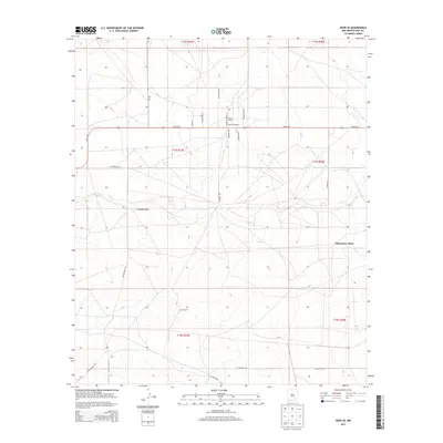
2013 Map of Hope SE
USGS Topo · Published 2013About this map
Old Horner Place and family holdings like Eaton Ranch anchor this portion of Eddy County, New Mexico, where the high desert landscape is etched by intermittent watercourses. The drainage of Eagle Cr and the topographical depression of Catclaw Draw define the central terrain, illustrating the sparse but strategic settlement patterns typical of the region's ranching heritage. This 2013 survey documents a network of named tracks and thoroughfares such as Hope Hwy and Rio Penasco Rd that connect isolated homesteads across the townships. Cultural landmarks like Laney Ranch serve as primary points of reference in an area defined by long-distance road names, including W Blevins Rd and Sagebrush Trl, which follow the grid of the Public Land Survey System. The map provides a clear record of land use and property access in the arid southeast, preserving the names of specific landholdings and the routes that tie them together.
Find a feature on this map
25 named features on this map. Tap any name to fly to it.
Don’t see what you’re looking for? This feature index may not catch every label — zoom into the map to look around manually.
Map Details
Editions of this 2013 Hope SE Map
This is the sole edition of this map. No revisions or reprints were ever made.
Other maps of this area

1953 · Espuela
USGS Topo · 1:24,000

1954 · Carlsbad
USGS Topo · 1:250,000

1955 · Artesia
USGS Topo · 1:24,000

1955 · Hope NW
USGS Topo · 1:24,000

1955 · Dayton
USGS Topo · 1:24,000

1955 · Hope NE
USGS Topo · 1:24,000

1955 · Hope
USGS Topo · 1:24,000

1956 · Hope
USGS Topo · 1:24,000

1956 · Parish Ranch
USGS Topo · 1:24,000

1956 · Antelope Sink
USGS Topo · 1:24,000