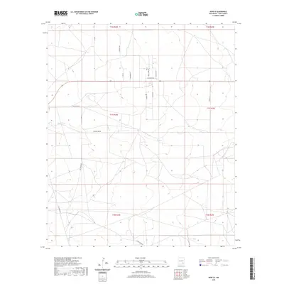
2020 Map of Hope SE
USGS Topo · Published 2020About this map
Rio Penasco Rd meanders across this southeastern New Mexico landscape, following the general path of the valley floor in Eddy County. The terrain is defined by the intermittent drainage of Eagle Creek, which winds through the central and eastern portions of the map, and the distinct incision of Catclaw Draw further south. This 2020 survey reveals a grid-like network of rural roads and residential lanes that have developed over time, including Sun Country Dr and Wagon Wheel Rd, suggesting a transition from open rangeland to sparse rural residential use. The survey also captures the intersection of several township and range lines, providing a modern perspective on the Public Land Survey System as it relates to contemporary infrastructure like W Four Dinnus Rd and Garnet Ln.
Find a feature on this map
20 named features on this map. Tap any name to fly to it.
Don’t see what you’re looking for? This feature index may not catch every label — zoom into the map to look around manually.
Map Details
Editions of this 2020 Hope SE Map
This is the sole edition of this map. No revisions or reprints were ever made.
Other maps of this area

1953 · Espuela
USGS Topo · 1:24,000

1954 · Carlsbad
USGS Topo · 1:250,000

1955 · Artesia
USGS Topo · 1:24,000

1955 · Hope NW
USGS Topo · 1:24,000

1955 · Dayton
USGS Topo · 1:24,000

1955 · Hope NE
USGS Topo · 1:24,000

1955 · Hope
USGS Topo · 1:24,000

1956 · Hope
USGS Topo · 1:24,000

1956 · Parish Ranch
USGS Topo · 1:24,000

1956 · Antelope Sink
USGS Topo · 1:24,000