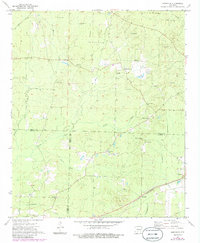
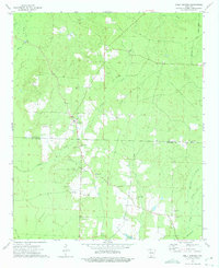
1973 Map of Hopeville
USGS Topo · Published 1986About this map
The St. Louis Southwestern railroad corridor defines the southeastern landscape of this South Arkansas region, where the three counties of Dallas, Ouachita, and Calhoun meet. The settlement of Hopeville serves as a central hub for a network of country churches and family burial grounds, including Hopeville Ch, Clemons Cem, and Double Springs Cem. This 1970s survey captures a rural economy of small-scale agriculture and timber, indicated by the many miles of fence and field lines recorded from aerial photography.
Find a feature on this map
38 named features on this map. Tap any name to fly to it.
Don’t see what you’re looking for? This feature index may not catch every label — zoom into the map to look around manually.
Map Details
Editions of this 1973 Hopeville Map
2 editions found
Other maps of this area

1903 · Camden
USGS Topo · 1:125,000

1953 · El Dorado
USGS Topo · 1:250,000

1957 · El Dorado
USGS Topo · 1:250,000

1958 · El Dorado
USGS Topo · 1:250,000

1960 · El Dorado
USGS Topo · 1:250,000

1966 · Fordyce
USGS Topo · 1:24,000
1969 · Ivan
USGS Topo · 1:24,000

1973 · Bearden
USGS Topo · 1:24,000
1973 · Eagle Mills
USGS Topo · 1:24,000
1973 · Holly Springs
USGS Topo · 1:24,000