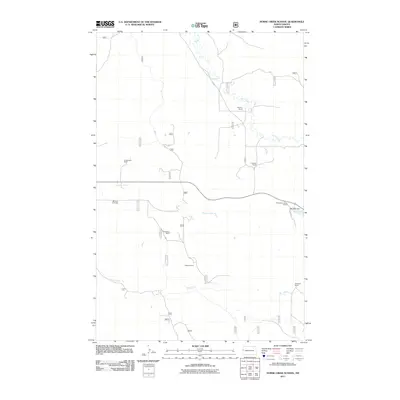
2011 Map of Horse Creek School
USGS Topo · Published 2011About this map
Mondak Oil Fields and a network of family-operated livestock operations define this section of McKenzie County in the early twenty-first century. The landscape is carved by the drainages of Horse Creek, Cheney Creek, and Alkali Creek, which dictate the placement of local infrastructure and the boundaries of generational holdings. The prominence of ranching culture is evident through the naming of specific properties such as the V Anderson Ranch, K Winter Ranch, and the Wambach Ranch.
Find a feature on this map
14 named features on this map. Tap any name to fly to it.
Don’t see what you’re looking for? This feature index may not catch every label — zoom into the map to look around manually.
Map Details
Editions of this 2011 Horse Creek School Map
This is the sole edition of this map. No revisions or reprints were ever made.
Other maps of this area

1909 · Glendive
USGS Topo · 1:250,000

1953 · Watford City
USGS Topo · 1:250,000

1954 · Glendive
USGS Topo · 1:250,000

1957 · Glendive
USGS Topo · 1:250,000

1957 · Watford City
USGS Topo · 1:250,000

1958 · Glendive
USGS Topo · 1:250,000

1966 · Sidney NE
USGS Topo · 1:24,000

1967 · Watford City
USGS Topo · 1:250,000

1972 · Horse Creek School
USGS Topo · 1:24,000
1972 · Fairview
USGS Topo · 1:24,000