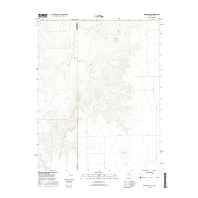
2016 Map of Horseshoe Hill
USGS Topo · Published 2016About this map
Horseshoe Hill rises above the High Plains landscape along the border of Texas and Oklahoma, serving as a prominent landmark in this semi-arid region. The drainage patterns of Palo Duro Cr and Cottonwood Cr carve through the terrain, indicating the seasonal water flow essential to local ranching and agriculture. Notable water features like Wampus Cat Springs and Peckenpaugh Lake provide rare focal points for the local ecosystem and historical land use. The map reveals a strict grid of section roads, such as Co RD 8 and Co RD H, which define the organized settlement of the Panhandle. Near the southern edge, the intersection of Fm 1267 and several county roads marks the sparse but vital transportation network connecting distant homesteads across the Hansford and Ochiltree county lines.
Find a feature on this map
18 named features on this map. Tap any name to fly to it.
Don’t see what you’re looking for? This feature index may not catch every label — zoom into the map to look around manually.
Map Details
Editions of this 2016 Horseshoe Hill Map
This is the sole edition of this map. No revisions or reprints were ever made.
Other maps of this area

1954 · Perryton
USGS Topo · 1:250,000

1958 · Perryton
USGS Topo · 1:250,000

1962 · Hansford Camp
USGS Topo · 1:24,000

1962 · Waka SW
USGS Topo · 1:24,000

1968 · Hardesty
USGS Topo · 1:24,000

1968 · Hardesty SE
USGS Topo · 1:24,000

1973 · Farnsworth
USGS Topo · 1:24,000

1973 · Horseshoe Hill
USGS Topo · 1:24,000

1973 · Waka
USGS Topo · 1:24,000

1973 · Bryans Corner SW
USGS Topo · 1:24,000