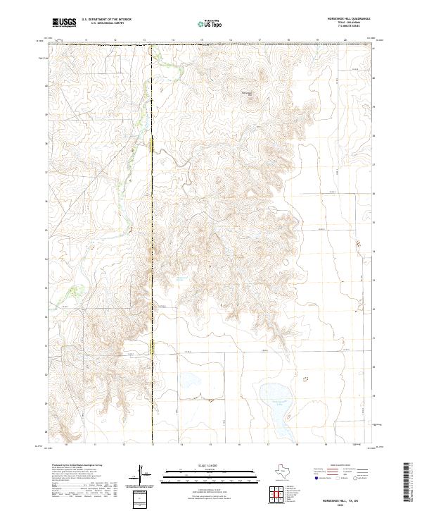
2022 Map of Horseshoe Hill
USGS Topo · Published 2022About this map
Palo Duro Cr flows through the western portion of this Panhandle landscape, marking a distinct topographical transition along the Hansford Co Ochiltree Co boundary. The area is defined by the elevation of Horseshoe Hill, overlooking a series of complex canyon-like drainage patterns that feed toward the north and east. This 2022 survey illustrates the remote water resources essential to this arid region, including Wampus Cat Springs and the broad expanse of Peckenpaugh Lake in the southern section. The road network is primarily composed of section-line county roads, though FM 1267 provides a primary north-south corridor on the eastern edge. The map captures the specialized land use of the High Plains, where the drainage of Cottonwood Cr carves into the plateau, creating the breaks that characterize the local geography.
Find a feature on this map
19 named features on this map. Tap any name to fly to it.
Don’t see what you’re looking for? This feature index may not catch every label — zoom into the map to look around manually.
Map Details
Editions of this 2022 Horseshoe Hill Map
This is the sole edition of this map. No revisions or reprints were ever made.
Other maps of this area

1954 · Perryton
USGS Topo · 1:250,000

1958 · Perryton
USGS Topo · 1:250,000

1962 · Hansford Camp
USGS Topo · 1:24,000

1962 · Waka SW
USGS Topo · 1:24,000

1968 · Hardesty
USGS Topo · 1:24,000

1968 · Hardesty SE
USGS Topo · 1:24,000

1973 · Farnsworth
USGS Topo · 1:24,000

1973 · Horseshoe Hill
USGS Topo · 1:24,000

1973 · Waka
USGS Topo · 1:24,000

1973 · Bryans Corner SW
USGS Topo · 1:24,000