
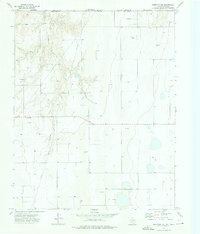
1973 Map of Horseshoe Hill
USGS Topo · Published 1975About this map
Palo Duro Creek cuts a winding path through the High Plains along the border of Hansford and Ochiltree Counties, just south of the Texas and Oklahoma state line. This 1970s landscape is defined by the extraction of natural resources, with numerous Gas Wells, Oil Wells, and several Gravel Pits scattered across the undulating terrain. The prominent Horseshoe Hill rises above the drainage basins, serving as a distinct landmark in an otherwise largely open and agricultural region.
Find a feature on this map
15 named features on this map. Tap any name to fly to it.
Don’t see what you’re looking for? This feature index may not catch every label — zoom into the map to look around manually.
Map Details
Editions of this 1973 Horseshoe Hill Map
This is the sole edition of this map. No revisions or reprints were ever made.
Other maps of this area

1954 · Perryton
USGS Topo · 1:250,000

1958 · Perryton
USGS Topo · 1:250,000

1962 · Hansford Camp
USGS Topo · 1:24,000

1962 · Waka SW
USGS Topo · 1:24,000

1968 · Hardesty
USGS Topo · 1:24,000

1968 · Hardesty SE
USGS Topo · 1:24,000

1973 · Farnsworth
USGS Topo · 1:24,000

1973 · Waka
USGS Topo · 1:24,000

1973 · Bryans Corner SW
USGS Topo · 1:24,000
1973 · Perryton NW
USGS Topo · 1:24,000