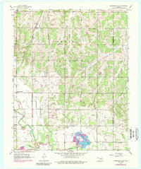
1956 Map of Horseshoe Lake
USGS Topo · Published 1989About this map
Horseshoe Lake serves as a focal point for this landscape along the border of Oklahoma and Lincoln counties, where industrial infrastructure meets rural settlement. The presence of a Powerplant and Substation at the lake's edge indicates the area's role in regional power generation during the mid-20th century. To the north and west, the terrain is defined by the drainage systems of Smith Creek and both forks of Wildhorse Creek, while the North Canadian River winds across the southern reaches.
Find a feature on this map
23 named features on this map. Tap any name to fly to it.
Don’t see what you’re looking for? This feature index may not catch every label — zoom into the map to look around manually.
Map Details
Editions of this 1956 Horseshoe Lake Map
4 editions found

Other maps of this area

1892 · Moore
USGS Topo · 1:62,500

1892 · Edmond
USGS Topo · 1:62,500

1898 · Purcell
USGS Topo · 1:125,000

1909 · Luther
USGS Topo · 1:62,500

1930 · McLoud
USGS Topo · 1:62,500

1934 · Moore
USGS Topo · 1:62,500

1935 · Edmond
USGS Topo · 1:48,000

1938 · Moore
USGS Topo · 1:62,500

1940 · Edmond
USGS Topo · 1:62,500

1954 · Oklahoma City
USGS Topo · 1:250,000