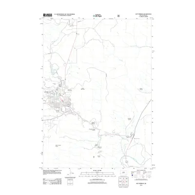
2012 Map of Hot Springs
USGS Topo · Published 2012About this map
Battle Mountain and the Seven Sisters Range dominate this landscape, where the town center is shaped by the confluence of Cold Brook Canyon and Hot Brook Canyon. The geography reflects a significant military and veteran presence, anchored by the South Dakota State Soldiers Home and the Hot Springs National Cemetery on the northern edge of the settlement. Water management is central to the area's development, evidenced by the reservoirs at Cold Brook Lake and Larive Lake, which feed into the Fall River as it winds southeast toward Dudley Canyon. The southern portion of the map transitions into the Big Flat plateau and the broader drainage of the Cheyenne River. Transportation routes like Skyline Drive and the local junction at Maverick Junction connect these various canyons and ridges, while the Flying T Airport provides small-scale aviation access to this isolated corner of Fall River County.
Find a feature on this map
52 named features on this map. Tap any name to fly to it.
Don’t see what you’re looking for? This feature index may not catch every label — zoom into the map to look around manually.
Map Details
Editions of this 2012 Hot Springs Map
This is the sole edition of this map. No revisions or reprints were ever made.
Other maps of this area

1894 · Hermosa
USGS Topo · 1:125,000

1896 · Oelrichs
USGS Topo · 1:125,000

1896 · Harney Peak
USGS Topo · 1:125,000

1900 · Oelrichs
USGS Topo · 1:125,000

1901 · Hermosa
USGS Topo · 1:125,000

1901 · Harney Peak
USGS Topo · 1:125,000

1902 · Edgemont
USGS Topo · 1:125,000

1950 · Hot Springs
USGS Topo · 1:24,000

1950 · Buffalo Gap
USGS Topo · 1:24,000

1950 · Cascade Springs
USGS Topo · 1:24,000