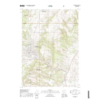
2017 Map of Hot Springs
USGS Topo · Published 2017About this map
The Hot Springs National Cemetery and Evergreen Cem stand as prominent landmarks in the landscape of this 2017 survey, serving as important focal points for genealogical research and local history. The town of Hot Springs sits at the convergence of several canyons, where the Fall River begins its course. To the north, the boundary of Wind Cave National Park meets the Black Hills National Forest, illustrating the region's long-standing transition from protected wilderness to settled municipal areas. The terrain is defined by a series of dramatic geographic features including the Seven Sisters Range and numerous carved-out pathways like Preacher Canyon and Slaughterhouse Canyon. Infrastructure such as Cold Brook Reservoir and the Flying T Airport highlight how the natural topography has been managed and utilized in the modern era.
Find a feature on this map
80 named features on this map. Tap any name to fly to it.
Don’t see what you’re looking for? This feature index may not catch every label — zoom into the map to look around manually.
Map Details
Editions of this 2017 Hot Springs Map
This is the sole edition of this map. No revisions or reprints were ever made.
Other maps of this area

1894 · Hermosa
USGS Topo · 1:125,000

1896 · Oelrichs
USGS Topo · 1:125,000

1896 · Harney Peak
USGS Topo · 1:125,000

1900 · Oelrichs
USGS Topo · 1:125,000

1901 · Hermosa
USGS Topo · 1:125,000

1901 · Harney Peak
USGS Topo · 1:125,000

1902 · Edgemont
USGS Topo · 1:125,000

1950 · Hot Springs
USGS Topo · 1:24,000

1950 · Buffalo Gap
USGS Topo · 1:24,000

1950 · Cascade Springs
USGS Topo · 1:24,000