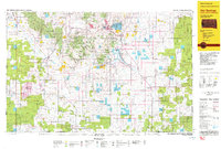
1993 Map of Hot Springs
USGS Topo · Published 1993About this map
Black Hills National Forest and the Buffalo Gap National Grassland dominate this section of the southern Black Hills region along the South Dakota and Nebraska border. The landscape is defined by the convergence of the Cheyenne River and its numerous tributaries, including Hat Creek and Beaver Creek, which feed into the large Angostura Reservoir. The Black Hills Ordnance Depot is a significant man-made landmark near the settlements of Igloo and Provo, highlighting the area's mid-century military footprint.
Find a feature on this map
80 named features on this map. Tap any name to fly to it.
Don’t see what you’re looking for? This feature index may not catch every label — zoom into the map to look around manually.
Map Details
Editions of this 1993 Hot Springs Map
This is the sole edition of this map. No revisions or reprints were ever made.
Other maps of this area

1894 · Hermosa
USGS Topo · 1:125,000

1896 · Oelrichs
USGS Topo · 1:125,000

1896 · Harney Peak
USGS Topo · 1:125,000

1899 · Newcastle
USGS Topo · 1:125,000

1900 · Oelrichs
USGS Topo · 1:125,000

1901 · Hermosa
USGS Topo · 1:125,000

1901 · Harney Peak
USGS Topo · 1:125,000

1901 · Newcastle
USGS Topo · 1:125,000

1902 · Edgemont
USGS Topo · 1:125,000

1950 · Hot Springs
USGS Topo · 1:24,000