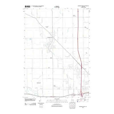
2010 Map of Howards Grove
USGS Topo · Published 2010About this map
Howards Grove serves as the central hub of this Sheboygan County landscape, where the Pigeon River and Fisher Creek wind through a grid of rural roads and expanding residential pockets. The area's Lutheran and Reformed heritage is clearly visible through a high concentration of denominational burying grounds, including the Trinity Evangelical Lutheran Cemetery and the Saint Paul Evangelical Reform Cemetery.
Find a feature on this map
49 named features on this map. Tap any name to fly to it.
Don’t see what you’re looking for? This feature index may not catch every label — zoom into the map to look around manually.
Map Details
Editions of this 2010 Howards Grove Map
This is the sole edition of this map. No revisions or reprints were ever made.
Other maps of this area

1954 · Sheboygan Falls
USGS Topo · 1:62,500

1954 · Sheboygan South
USGS Topo · 1:62,500

1954 · School Hill
USGS Topo · 1:24,000

1954 · Sheboygan Falls
USGS Topo · 1:24,000

1954 · Cleveland
USGS Topo · 1:24,000

1954 · St. Wendel
USGS Topo · 1:24,000

1954 · Sheboygan North
USGS Topo · 1:62,500

1954 · Sheboygan North
USGS Topo · 1:24,000

1954 · Sheboygan South
USGS Topo · 1:24,000

1954 · Howards Grove
USGS Topo · 1:62,500