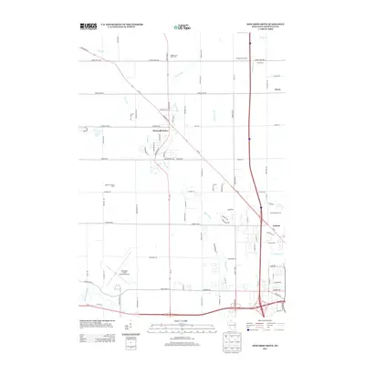
2013 Map of Howards Grove
USGS Topo · Published 2013About this map
Howards Grove serves as the central hub of this agricultural and transit corridor in Sheboygan County, where State Road 42 and State Road 32 converge. The landscape is defined by the winding course of the Pigeon River and its tributaries, including Fisher Creek and Sevenmile Creek. This 2013 survey illustrates the enduring importance of the local dairy industry, marking numerous active operations such as Badger Land Dairy Farm, Highland Crossing Dairy, and D and R Dairy. To the east, the small settlement of Haven sits near the lakeshore plain, while Erdman anchors the southeastern corner. The southwestern portion of the quadrangle is dominated by the Sheboygan County Memorial Airport, situated along County Hwy-O, reflecting the region's connection to broader transportation networks alongside its traditional orchard and farming roots, seen at Whispering Orchards.
Find a feature on this map
83 named features on this map. Tap any name to fly to it.
Don’t see what you’re looking for? This feature index may not catch every label — zoom into the map to look around manually.
Map Details
Editions of this 2013 Howards Grove Map
This is the sole edition of this map. No revisions or reprints were ever made.
Other maps of this area

1954 · Sheboygan Falls
USGS Topo · 1:62,500

1954 · Sheboygan South
USGS Topo · 1:62,500

1954 · School Hill
USGS Topo · 1:24,000

1954 · Sheboygan Falls
USGS Topo · 1:24,000

1954 · Cleveland
USGS Topo · 1:24,000

1954 · St. Wendel
USGS Topo · 1:24,000

1954 · Sheboygan North
USGS Topo · 1:62,500

1954 · Sheboygan North
USGS Topo · 1:24,000

1954 · Sheboygan South
USGS Topo · 1:24,000

1954 · Howards Grove
USGS Topo · 1:62,500