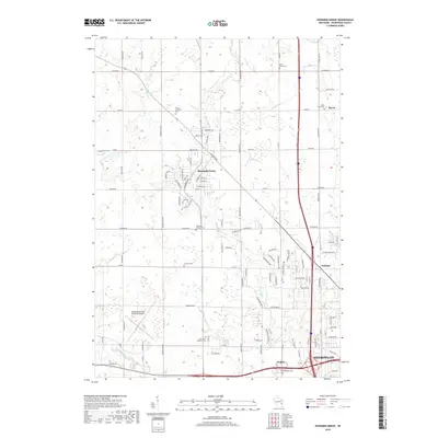
2018 Map of Howards Grove
USGS Topo · Published 2018About this map
The Pigeon River and its tributaries, including Sevenmile Cr and Fisher Cr, define the drainage patterns across this Sheboygan County landscape. The village of Howards Grove serves as a central junction, while the southern edge transition into the urban reach of Sheboygan and the planned community of Kohler. This 2018 survey reveals a high density of rural cemeteries that mark the area's ancestral heritage, such as Saint Paul Friedhof Cem, Trinity Lutheran Cem, and the uniquely named Concord Cem. Significant infrastructure like the Sheboygan County Memorial Airport and the winding course of the Sheboygan River in the southwest corner contrast with the systematic agricultural grid. Small settlements like Haven and Erdman persist along the northern and eastern road corridors, reflecting a landscape where legacy farmsteads and modern development meet.
Find a feature on this map
108 named features on this map. Tap any name to fly to it.
Don’t see what you’re looking for? This feature index may not catch every label — zoom into the map to look around manually.
Map Details
Editions of this 2018 Howards Grove Map
This is the sole edition of this map. No revisions or reprints were ever made.
Other maps of this area

1954 · Sheboygan Falls
USGS Topo · 1:62,500

1954 · Sheboygan South
USGS Topo · 1:62,500

1954 · School Hill
USGS Topo · 1:24,000

1954 · Sheboygan Falls
USGS Topo · 1:24,000

1954 · Cleveland
USGS Topo · 1:24,000

1954 · St. Wendel
USGS Topo · 1:24,000

1954 · Sheboygan North
USGS Topo · 1:62,500

1954 · Sheboygan North
USGS Topo · 1:24,000

1954 · Sheboygan South
USGS Topo · 1:24,000

1954 · Howards Grove
USGS Topo · 1:62,500