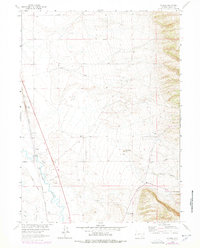
1963 Map of Howell
USGS Topo · Published 1978About this map
The Union Pacific railroad line forms the backbone of this high plains landscape, running parallel to the winding course of the Laramie River north of Laramie. This 1963 survey, updated with 1970s revisions, illustrates a transition from traditional ranching to modern infrastructure, where named homesteads like the Lundberg Ranch and Bosler Ranch sit alongside complex water management systems. The reliance on irrigation in this arid environment is evident through the presence of the Pioneer Canal and North Canal, which divert water across the flats. To the east, the terrain rises into named features such as Red Hill and Katie Brown Canyon, while local industry is represented by a Quarry and a Gravel Pit. Near the settlement of Howell, an Old Railroad Grade remains visible, marking the shifts in transport history throughout Albany County.
Find a feature on this map
24 named features on this map. Tap any name to fly to it.
Don’t see what you’re looking for? This feature index may not catch every label — zoom into the map to look around manually.
Map Details
Editions of this 1963 Howell Map
2 editions found
Other maps of this area

1895 · Laramie
USGS Topo · 1:125,000

1902 · Laramie
USGS Topo · 1:125,000

1905 · Sherman
USGS Topo · 1:125,000

1905 · Laramie
USGS Topo · 1:125,000

1906 · Laramie
USGS Topo · 1:125,000

1908 · Laramie
USGS Topo · 1:125,000

1948 · Ragged Top Mountain
USGS Topo · 1:62,500

1950 · Ragged Top Mountain
USGS Topo · 1:62,500

1954 · Cheyenne
USGS Topo · 1:250,000

1955 · Bosler
USGS Topo · 1:24,000