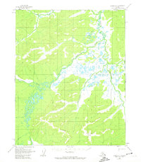
1955 Map of Hughes A-1
USGS Topo · Published 1974About this map
The Sushgitit Hills dominate the southern landscape of this interior Alaska region, marking a significant upland area where elevations reach toward the VABM 1987 Shelter landmark. This 1955 survey captures an intricate drainage system defined by the Mentanontli River and the Hovadazithetno River, which meander through extensive wetlands. The presence of a Pingo near the center of the quadrangle serves as a distinct indicator of permafrost activity in the Notoniono Creek valley. These features, along with the Slathlouka Creek and the southern Indian River, illustrate a landscape shaped by seasonal water flow and subarctic geomorphology before modern infrastructure reached this part of the Kateel River Meridian.
Find a feature on this map
10 named features on this map. Tap any name to fly to it.
Don’t see what you’re looking for? This feature index may not catch every label — zoom into the map to look around manually.
Map Details
Editions of this 1955 Hughes A-1 Map
3 editions found
Other maps of this area

1951 · Hughes
USGS Topo · 1:250,000

1951 · Melozitna
USGS Topo · 1:250,000

1951 · Bettles
USGS Topo · 1:250,000

1951 · Tanana
USGS Topo · 1:250,000

1952 · Melozitna D-1
USGS Topo · 1:63,360

1955 · Melozitna D-2
USGS Topo · 1:63,360

1955 · Hughes A-2
USGS Topo · 1:63,360

1955 · Hughes A-1
USGS Topo · 1:63,360

1956 · Hughes
USGS Topo · 1:250,000

1956 · Bettles
USGS Topo · 1:250,000