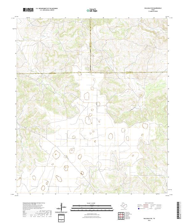
2022 Map of Hulldale SW
USGS Topo · Published 2022About this map
Bois D'Arc Draw meanders through this section of West Texas, where the boundaries of Irion, Tom Green, and Schleicher counties converge. The landscape is defined by the transition from the Edwards Plateau into the rolling ranch lands of the Concho Valley region. Human activity is marked by a sparse network of rural routes, including the prominent Ranch Rd 915 and local paths such as Case Rd and Meltzon. These roads trace the contours of the draws and ridges, reflecting a settlement pattern dictated by the semi-arid terrain and the needs of large-scale livestock operations. This 2022 survey provides an essential view of contemporary land divisions and water drainage patterns like Co Rd 418 in a region where geography and property lines are often the primary landmarks.
Find a feature on this map
9 named features on this map. Tap any name to fly to it.
Don’t see what you’re looking for? This feature index may not catch every label — zoom into the map to look around manually.
Map Details
Editions of this 2022 Hulldale SW Map
This is the sole edition of this map. No revisions or reprints were ever made.
Other maps of this area

1895 · Sherwood
USGS Topo · 1:125,000

1954 · Sonora
USGS Topo · 1:250,000

1954 · San Angelo
USGS Topo · 1:250,000

1958 · Sonora
USGS Topo · 1:250,000

1958 · San Angelo
USGS Topo · 1:250,000

1964 · Eldorado NW
USGS Topo · 1:24,000
1964 · Eldorado NE
USGS Topo · 1:24,000

1964 · Moore Ranch
USGS Topo · 1:24,000

1965 · San Angelo
USGS Topo · 1:250,000
1972 · Hulldale NW
USGS Topo · 1:24,000