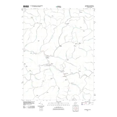
2011 Map of Hundred
USGS Topo · Published 2011About this map
West Virginia Fork Fish Creek carves a deep path through this section of the northern panhandle, anchoring a landscape defined by narrow hollows and steep ridgelines. The settlement of Hundred serves as a central hub for the surrounding rural communities of Burton, Garrison, and Saint Cloud. Engineering landmarks like the Marshall Tunnel and Soles Tunnel reflect the historic transportation corridor following the creek, while the Fish Creek Covered Bridge near Cusicks Crossing stands as a notable remnant of local infrastructure.
Find a feature on this map
117 named features on this map. Tap any name to fly to it.
Don’t see what you’re looking for? This feature index may not catch every label — zoom into the map to look around manually.
Map Details
Editions of this 2011 Hundred Map
This is the sole edition of this map. No revisions or reprints were ever made.
Other maps of this area

1903 · Littleton
USGS Topo · 1:62,500

1904 · Cameron
USGS Topo · 1:62,500

1905 · Mannington
USGS Topo · 1:62,500

1905 · Rogersville
USGS Topo · 1:62,500

1905 · Littleton
USGS Topo · 1:62,500

1923 · Mannington
USGS Topo · 1:62,500

1924 · Littleton
USGS Topo · 1:62,500

1926 · Littleton
USGS Topo · 1:62,500

1926 · Mannington
USGS Topo · 1:62,500

1935 · Cameron
USGS Topo · 1:62,500