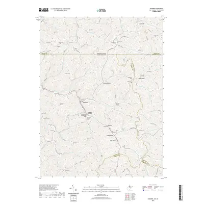
2019 Map of Hundred
USGS Topo · Published 2019About this map
Hundred serves as the central hub of this northern West Virginia landscape, situated where the W Virginia Fork Fish Cr and several tributaries converge. The town's historical infrastructure is notably preserved through landmarks such as the Hundred Cover Bridge and the nearby Fish Creek Covered Bridge. The map details a complex network of ridges and hollows, including Bee Hollow and Edgell Hollow, which have shaped local settlement patterns for generations. To the west, the engineering of the Marshall Tunnel and Soles Tunnel reflects the historical necessity of navigating this high-relief terrain.
Find a feature on this map
111 named features on this map. Tap any name to fly to it.
Don’t see what you’re looking for? This feature index may not catch every label — zoom into the map to look around manually.
Map Details
Editions of this 2019 Hundred Map
This is the sole edition of this map. No revisions or reprints were ever made.
Other maps of this area

1903 · Littleton
USGS Topo · 1:62,500

1904 · Cameron
USGS Topo · 1:62,500

1905 · Mannington
USGS Topo · 1:62,500

1905 · Rogersville
USGS Topo · 1:62,500

1905 · Littleton
USGS Topo · 1:62,500

1923 · Mannington
USGS Topo · 1:62,500

1924 · Littleton
USGS Topo · 1:62,500

1926 · Littleton
USGS Topo · 1:62,500

1926 · Mannington
USGS Topo · 1:62,500

1935 · Cameron
USGS Topo · 1:62,500