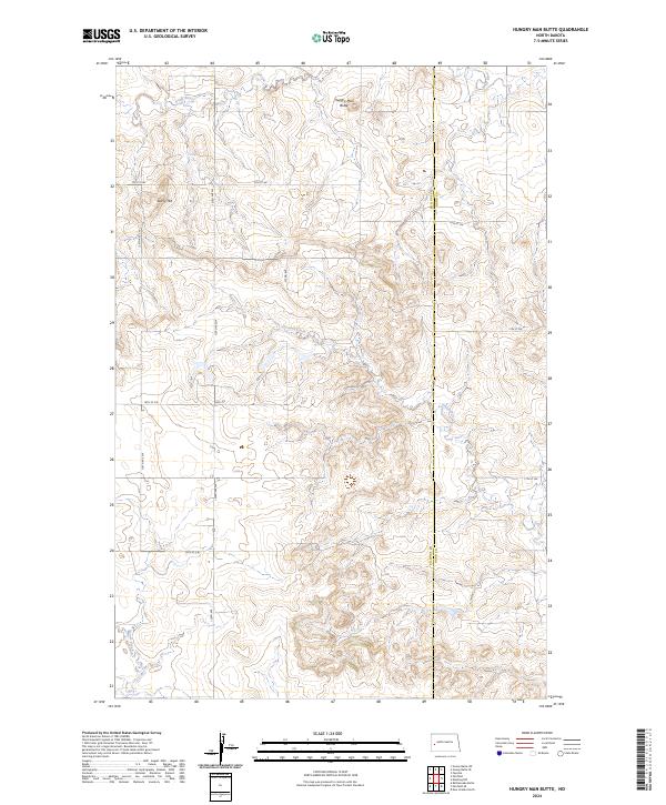
2024 Map of Hungry Man Butte
USGS Topo · Published 2024About this map
Hungry Man Butte rises prominently above the complex drainage systems of the western Dakotas, where the Knife River and Crooked Creek carve into the high plains. This landscape is defined by the transition between the rolling uplands of Rocky Hill and the riparian corridors that historically dictated movement across this territory. The map reveals a strict section-line road grid, including 13th St SW and 124th Ave SW, which cuts across the natural topography of the Billings and Dunn County border. This intersection of systematic land survey and rugged watercourses like Horse Creek highlights the enduring pattern of ranching and remote settlement in North Dakota’s interior.
Find a feature on this map
24 named features on this map. Tap any name to fly to it.
Don’t see what you’re looking for? This feature index may not catch every label — zoom into the map to look around manually.
Map Details
Editions of this 2024 Hungry Man Butte Map
This is the sole edition of this map. No revisions or reprints were ever made.
Other maps of this area

1953 · Watford City
USGS Topo · 1:250,000

1957 · Watford City
USGS Topo · 1:250,000

1963 · Fairfield SE
USGS Topo · 1:24,000

1963 · Fairfield
USGS Topo · 1:24,000

1963 · Rattlesnake Butte
USGS Topo · 1:24,000

1963 · Hungry Man Butte
USGS Topo · 1:24,000

1967 · Watford City
USGS Topo · 1:250,000
1973 · New Hradec North
USGS Topo · 1:24,000

1973 · Manning NW
USGS Topo · 1:24,000

1974 · Killdeer
USGS Topo · 1:100,000