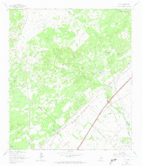
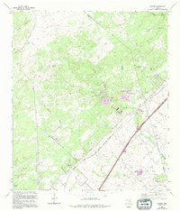
1964 Map of Hunter
USGS Topo · Published 1974About this map
The community of Hunter sits at the junction of the Missouri Pacific and Missouri - Kansas - Texas railroads, marking a landscape defined by ranching and transit. Large landholdings like the Wegner Ranch and Circle Dot Ranch dominate the higher ground, while the southern reaches are crisscrossed by a network of creeks including York Creek and Alligator Creek. This 1964 survey captures the rural character of the area before the expansion of the nearby corridor, preserving the locations of numerous small family burial grounds.
Find a feature on this map
29 named features on this map. Tap any name to fly to it.
Don’t see what you’re looking for? This feature index may not catch every label — zoom into the map to look around manually.
Map Details
Editions of this 1964 Hunter Map
5 editions found
Other maps of this area

1911 · San Marcos
USGS Topo · 1:125,000

1919 · San Marcos
USGS Topo · 1:125,000

1925 · New Braunfels No 1
USGS Topo · 1:48,000

1925 · Hunter No 3
USGS Topo · 1:48,000

1927 · New Braunfels
USGS Topo · 1:62,500

1929 · Hunter
USGS Topo · 1:62,500

1930 · Seguin
USGS Topo · 1:62,500

1953 · Seguin
USGS Topo · 1:250,000

1954 · San Antonio
USGS Topo · 1:250,000

1957 · San Antonio
USGS Topo · 1:250,000